Road Trip Along US Highway 395
Los Angeles to Lee Vining (Mono Lake and Bodie),
Tejon Pass to Yosemite, then San Francisco Bay Area
Los Angeles to Lee Vining (Mono Lake and Bodie),
Tejon Pass to Yosemite, then San Francisco Bay Area
photos by G.P. Jones using Nikon Coolpix 4300 digital
camera, except where noted
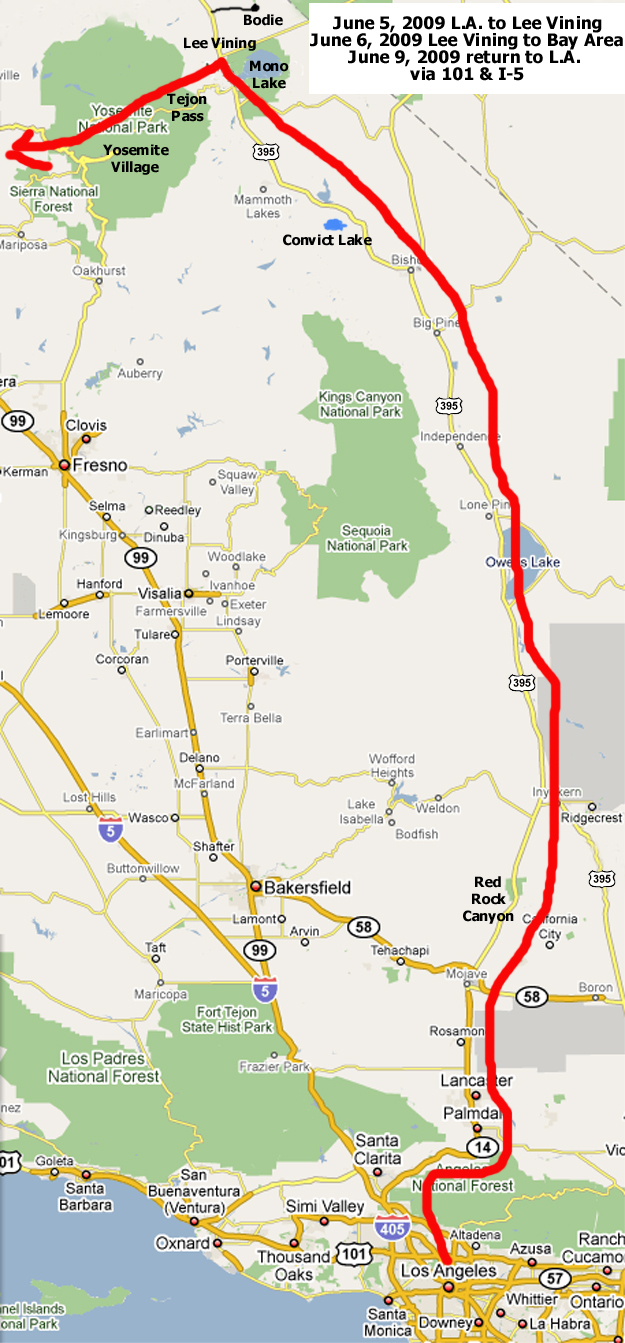
This map shows the Northbound segments of the trip, travelled on June 5 and 6, 2009
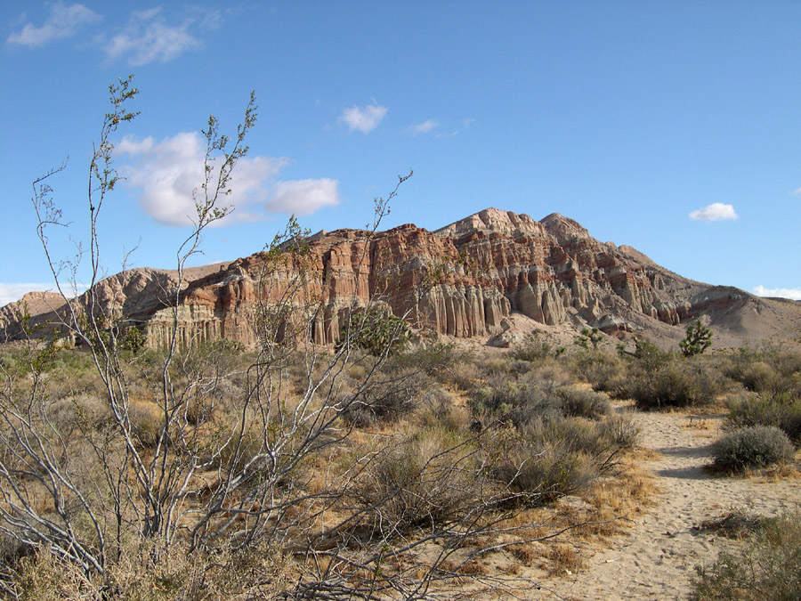
Red Rock Canyon State Recreation Area on
California Highway 14, North of Mojave on the way to US 395
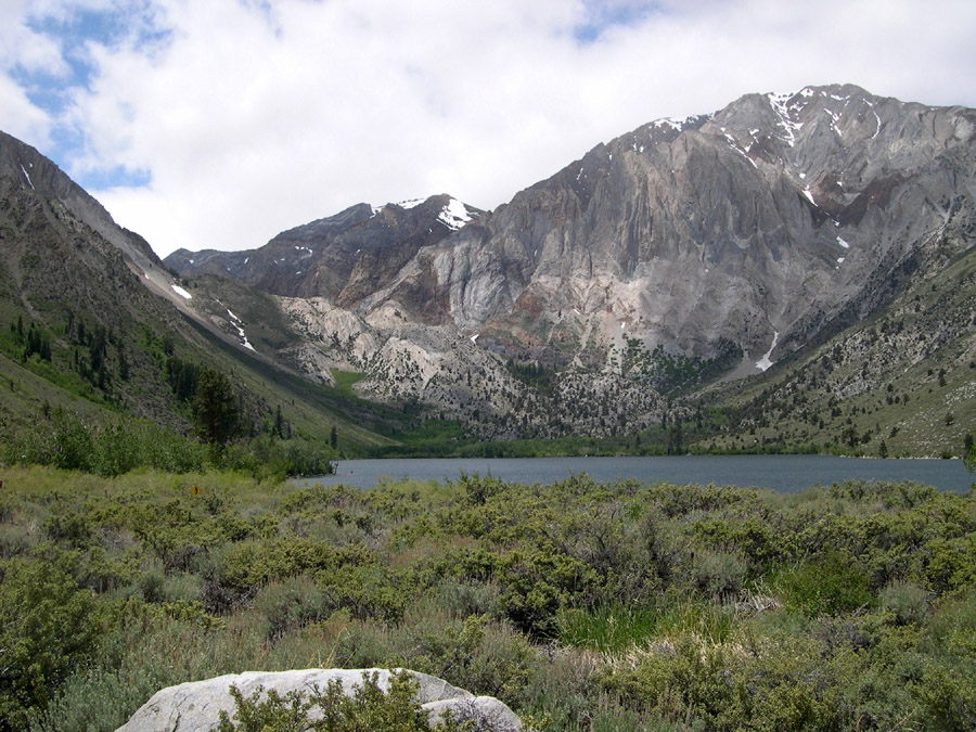
Convict Lake (south of Mammoth Lakes) is so named because in the
1800s some escapees from a Nevada prison were captured (well, killed)
near here.
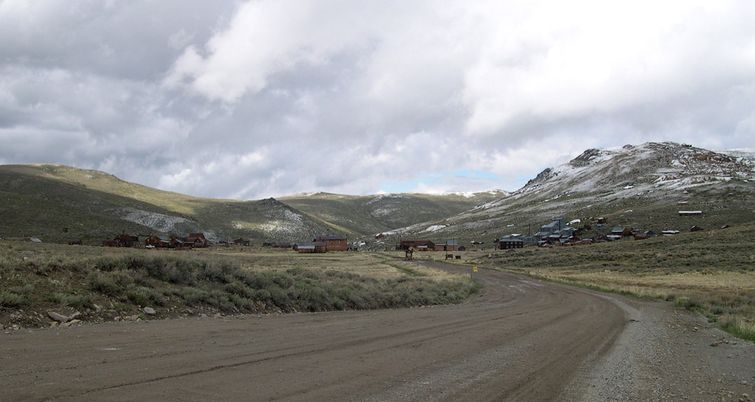
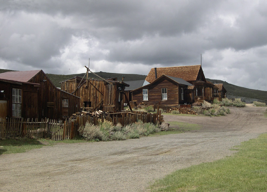
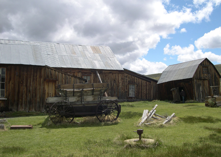
North of Lee Vining, where I was going to spend the first night, is a
true ghost town called Bodie. It lies on a dirt road, about 14 miles
from Highway 395, and is well worth visiting.
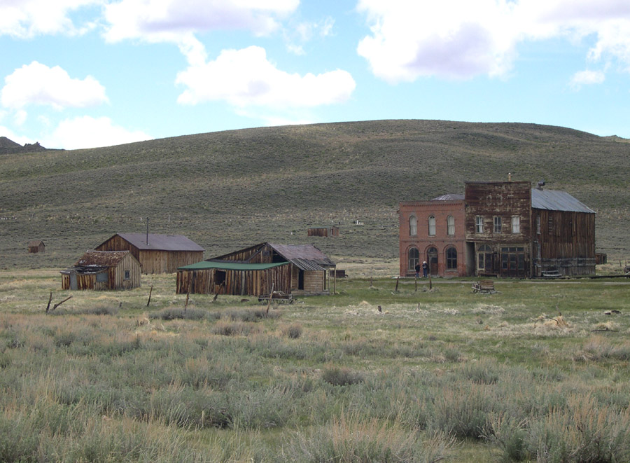
Bodie is a State Park, which the state says it keeps in a condition of
"arrested decay".
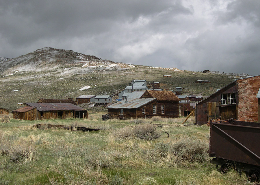
This is no movie set. It really is in the condition it was in when it
was deserted in the early 20th Century. I wouldn't go there at night.
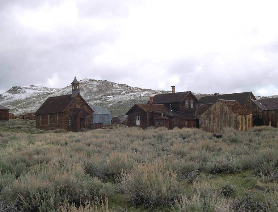
This view shows the only remaining church (Methodist) in the town.
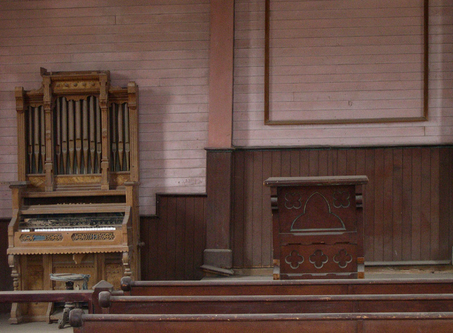
This is a view of the inside of the church. Except for some vandalism
and theft, it is just as it was left when the town was deserted.
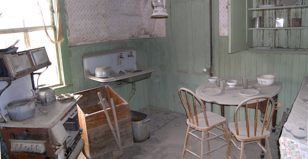
Visitors can look inside (but not enter) a few of the homes and businesses.
This is a composite picture, joined by tricks of PhotoShop to see a wider view.
You may need to SCROLL RIGHT to see the entire image.

This signpost shows where the shore of Mono Lake was in 1941. From then until
the 1980s or so the water normally flowing into the lake was diverted to thirsty
Los Angeles, and the water level dropped dramatically. Because of conservation
efforts and legal action, it has recovered somewhat and continues to rise,
but as you can see here, it is a VERY long way down from where it was in 1941.
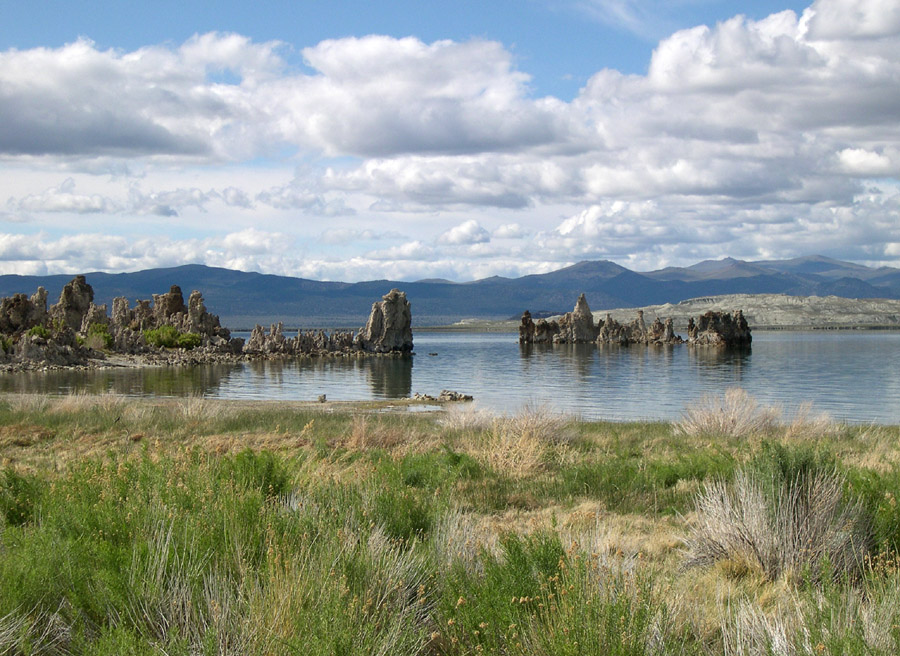
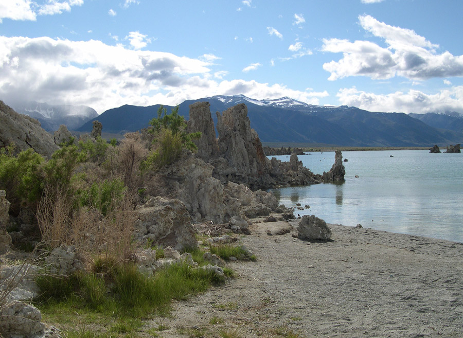
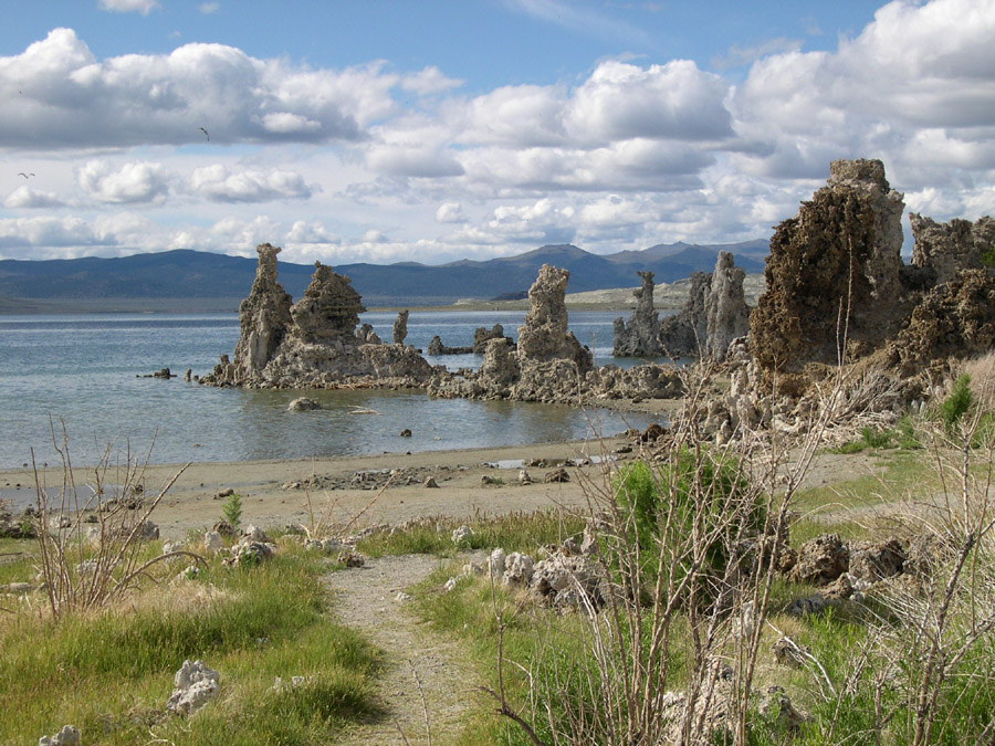
I nearly missed visiting the South Tufa area of Mono Lake, because when I
drove by the first time, I couldn't see much. After visiting Bodie, it was
still light, so I went back to the South Tufa and got out of the car. All the
wonder of the Tufa beds was just behind the tiny hills.
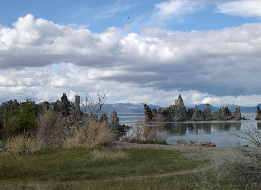
Tufa towers are mineral deposits that develop entirely
underwater. Yes, this means that all these tufa spires, knobs and "walls"
originally were below the surface of Mono Lake.
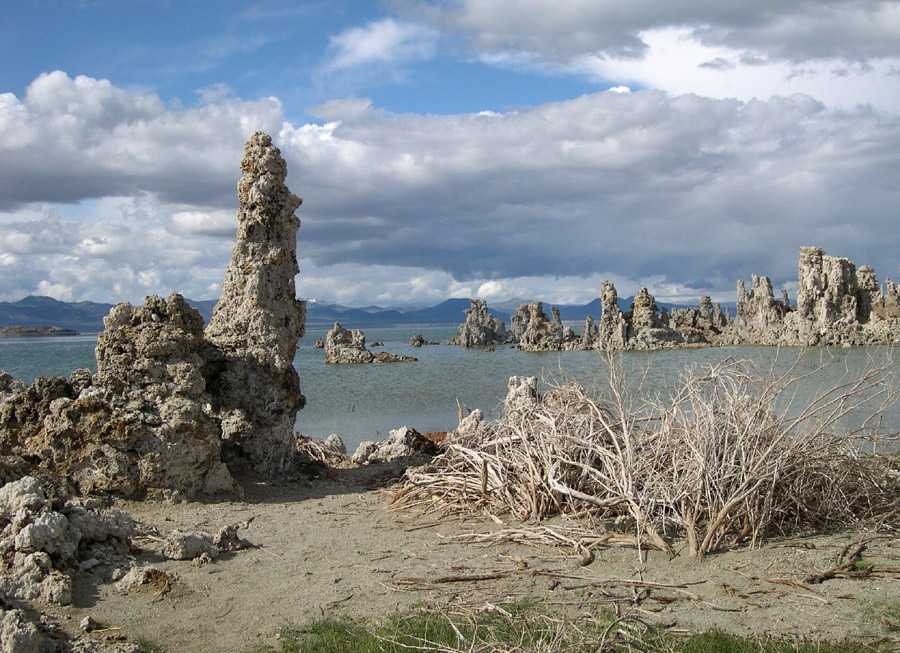

This Tufa formation looks to me like a castle or monastery (vaguely reminiscent
of Mont Saint Michel in France, when it is surrounded by water. Somehow, I see a
"doorway" in the middle, and a "window" above it and to the right.
From Lee Vining, one goes to Yosemite on Highway 120, through the Tioga Pass.
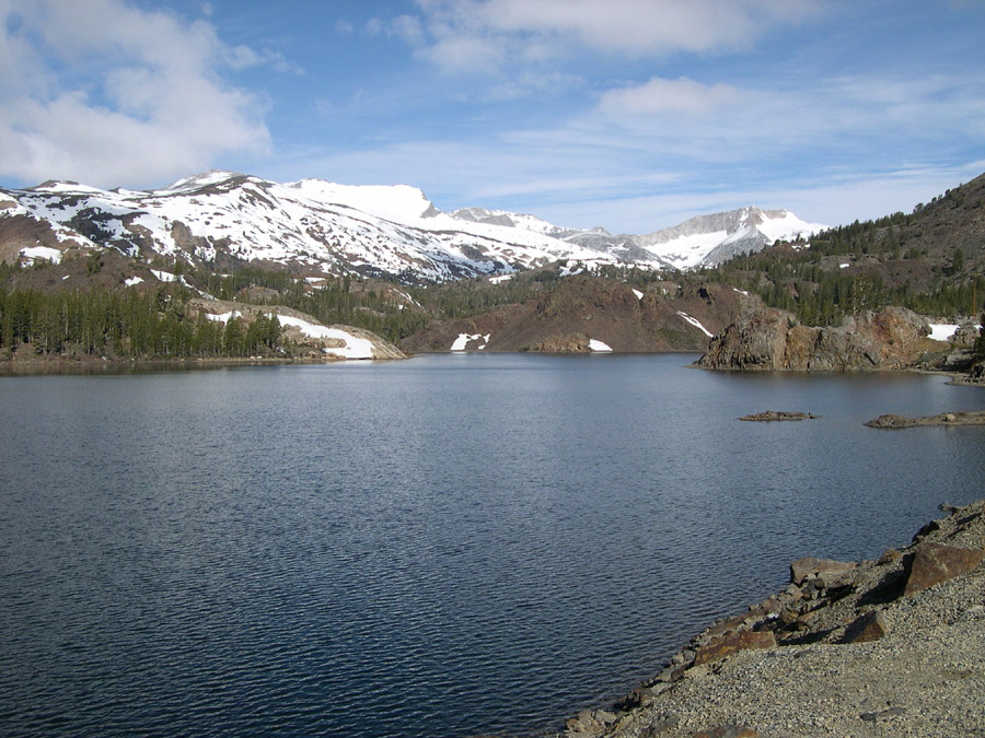
The road is quite scenic. This is Ellery Lake, which sits at about 9538 feet elevation.
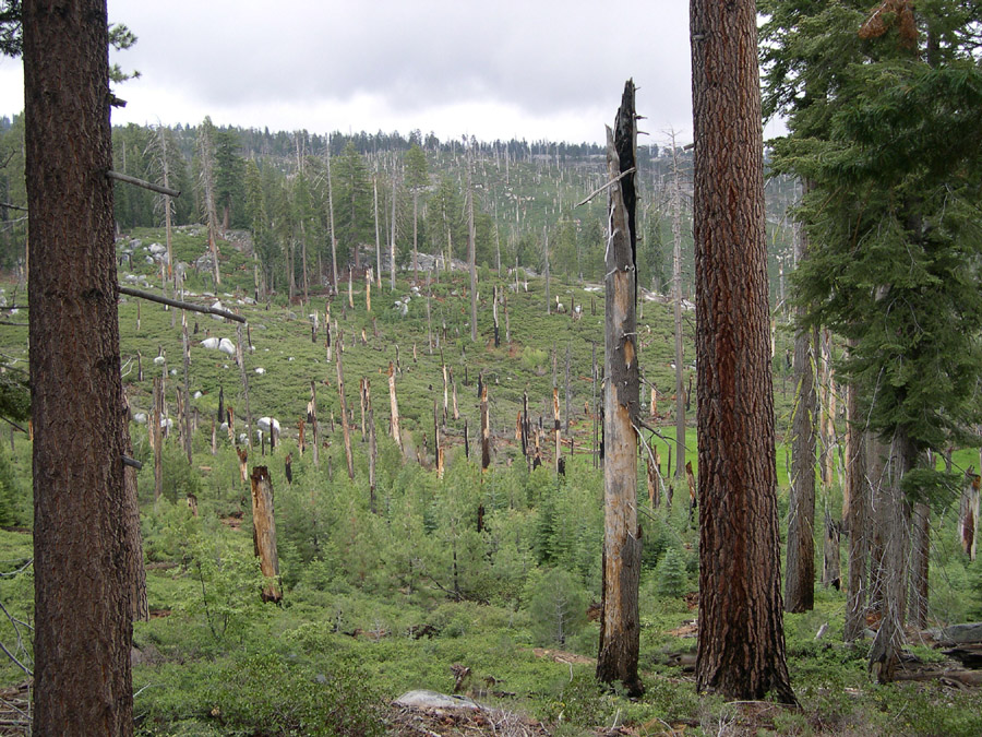
Some forest fires are natural and even beneficial for the ecology of the area.
I don't know whether this recent burn in the Tioga Pass was a natural or man-made fire.

Further along toward Yosemite is the stunning Tenaya Lake.
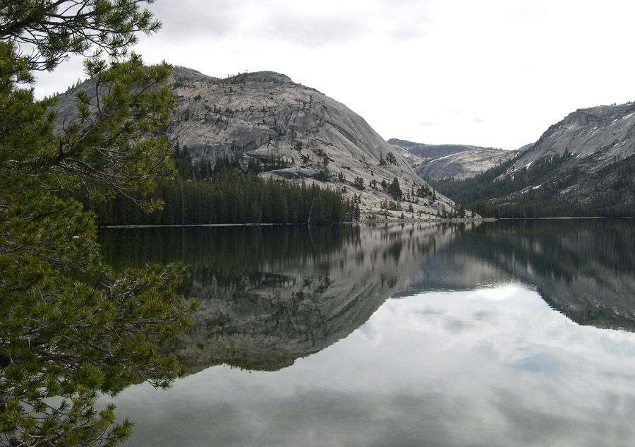
Another view of Tenaya Lake on Highway 120 in the Tioga Pass.
This Highway is closed in the Winter.
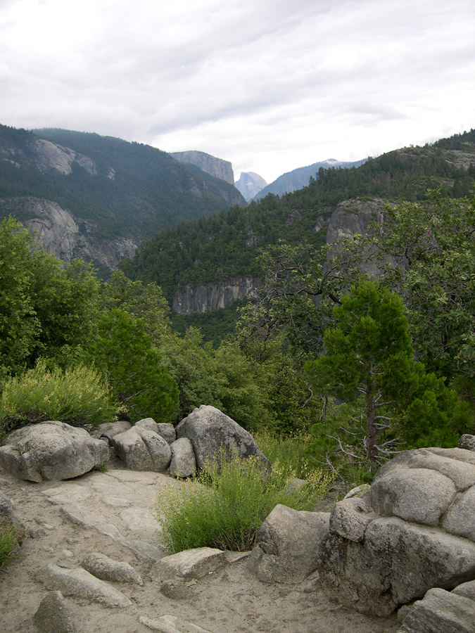
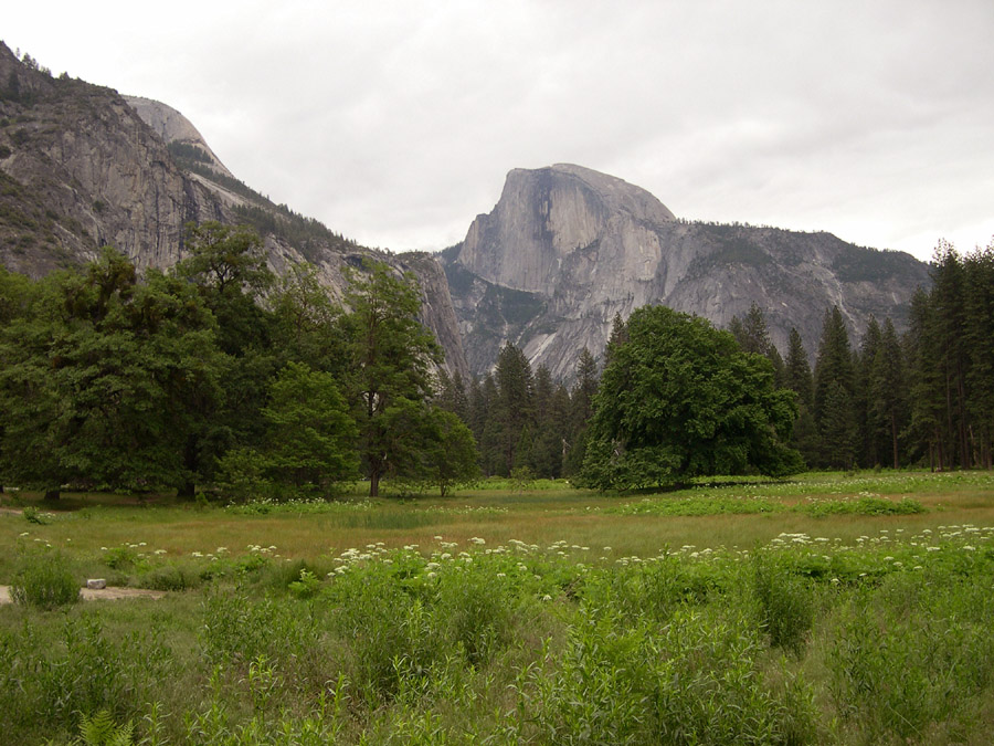
After entering Yosemite National Park you are still many miles away from
the Yosemite Valley. The approach to the valley has many spectacular sights
including this view of Half Dome in the "V" formed by the surrounding mountains.
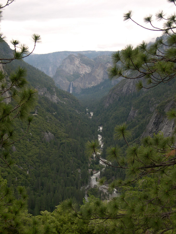
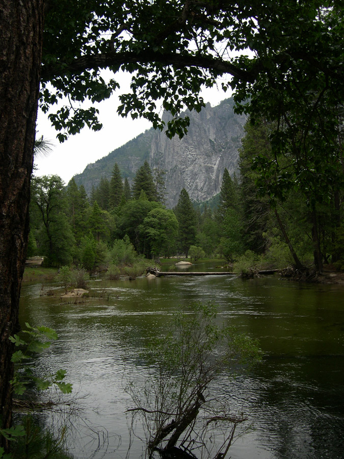
Getting closer to the Yosemite Valley, there is this waterfall (I don't know
which one; Bridalveil Fall?) and the Merced River running Westward.

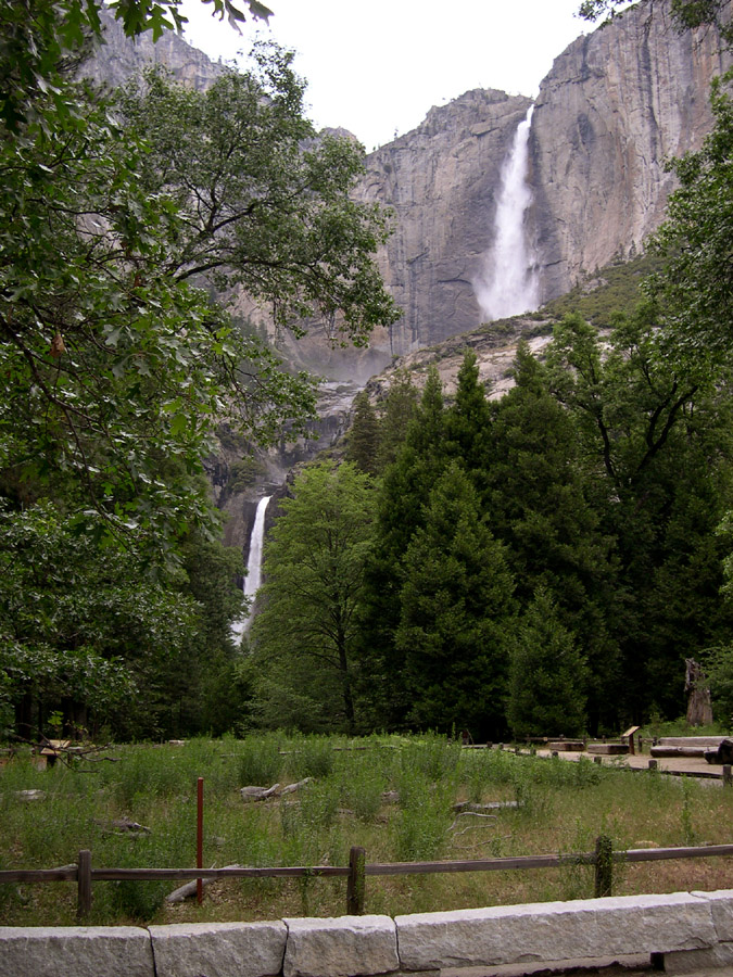
This is Bridalveil Fall, photographed from the parking lot.
On this visit to Yosemite, there was one distinguishing characteristic above
all others: HORDES OF PEOPLE. It wasn't even high-summer season yet, and
the weather was cold and overcast, yet the park was jammed. I avoided people
and cars in my pictures, of course, but they are, unfortunately,
the main attraction -- I should say distraction -- of Yosemite in the 21st
Century. It may be time to begin requiring reservations for visits to this
heaven on earth. What a shame.
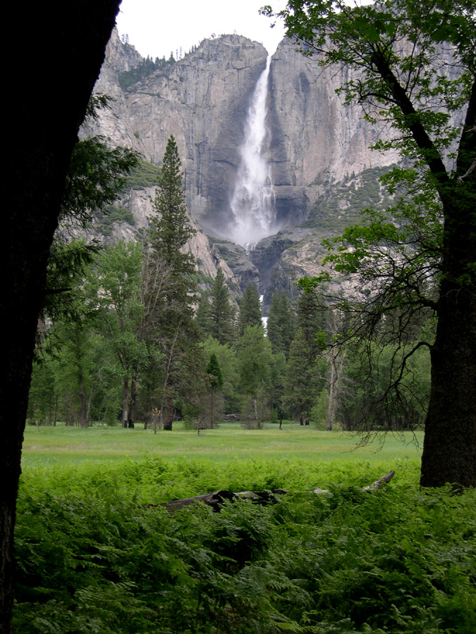
This "set" of waterfalls -- Upper and Lower Yosemite Falls -- seems to
be visible from everywhere. Here are two different views.
Leaving Yosemite, traveling generally Westward, is just as scenic as the entry
from the East through the Tioga Pass. This is the Merced River, looking back
towards the Yosemite Valley.
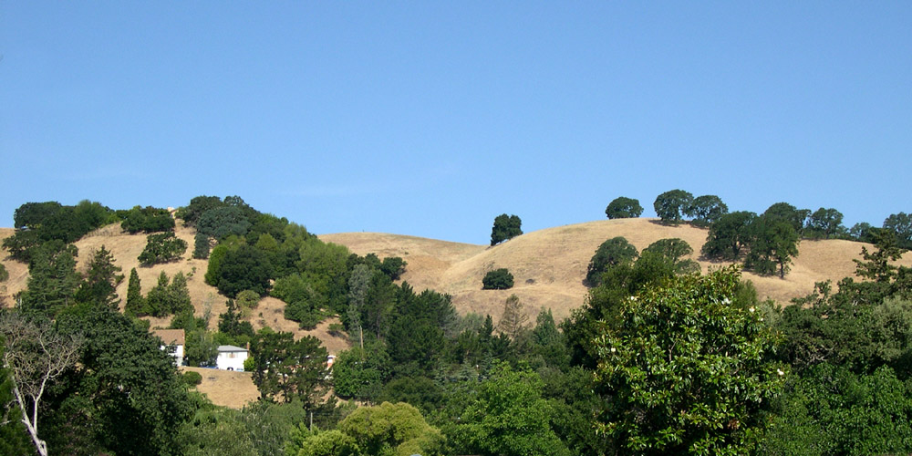
Back on the "flatland" NorthWest of Yosemite, things aren't nearly as interesting, but the small towns there do have some attractions.

The San Francisco Bay Area is another human jungle, but the setting is still
pretty nice in spots. This is Martinez, California, about 20 minutes away from Berkeley and the Bay.
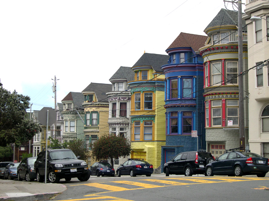
The architecture of San Francisco is nothing if not colorful. These houses
are on Central Avenue, seen from Haight Street, just at the foot of the quite
beautiful Buena Vista Park.

I must admit I didn't know this. You learn something every day.
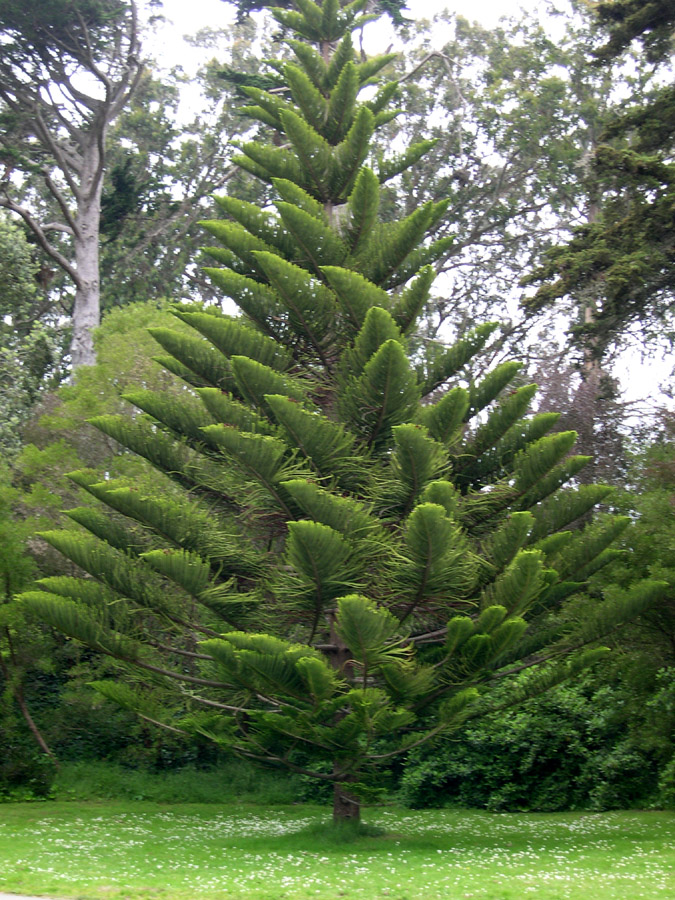
San Francisco's Golden Gate Park is truly remarkable. Lakes, lotsa trees
and other vegetation, a windmill, soccer fields, and on and on.
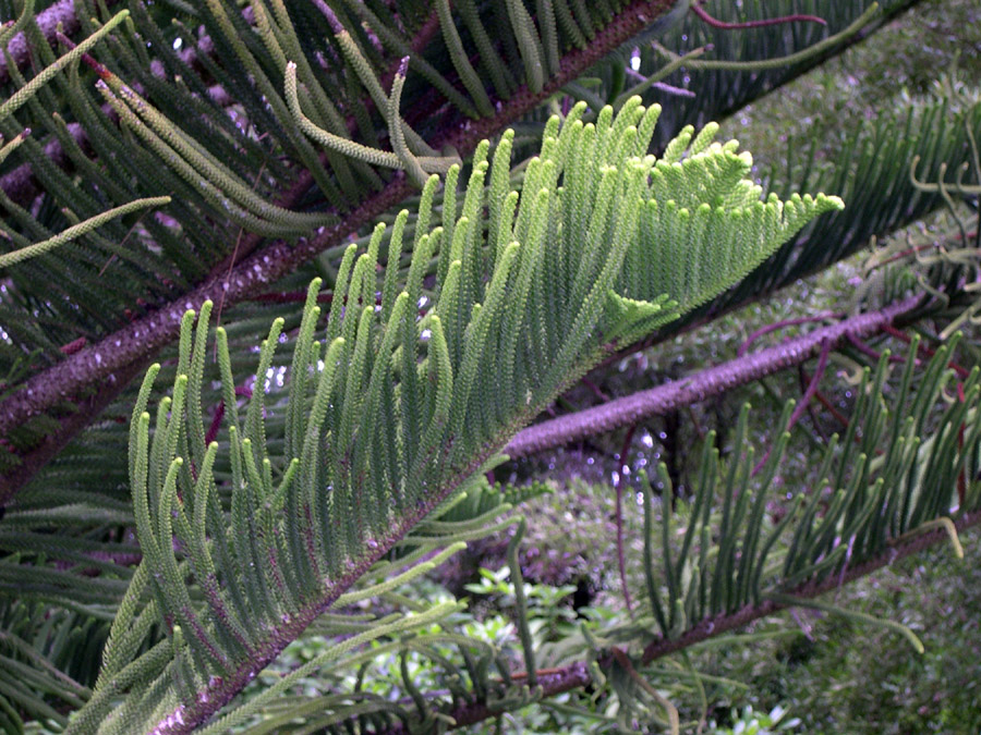
This tree seemed to "stand out", so I photographed it, and then
went in close for the next two views.

It's funny, but I don't remember all the violet/pinkish stuff when I was
taking these pictures.
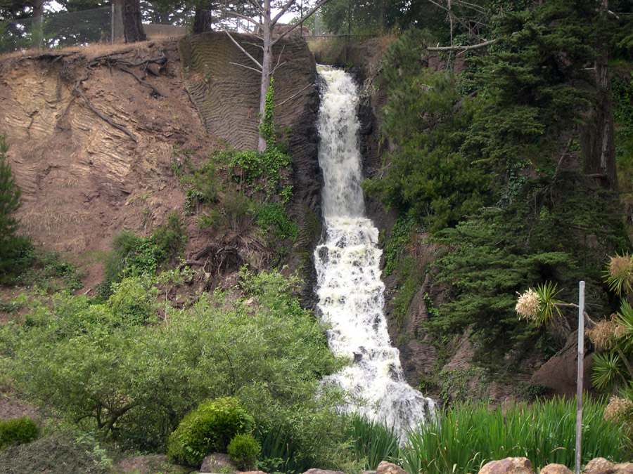
Another waterfall, like Yosemite? Maybe, but this one is in the middle
of Golden Gate Park.
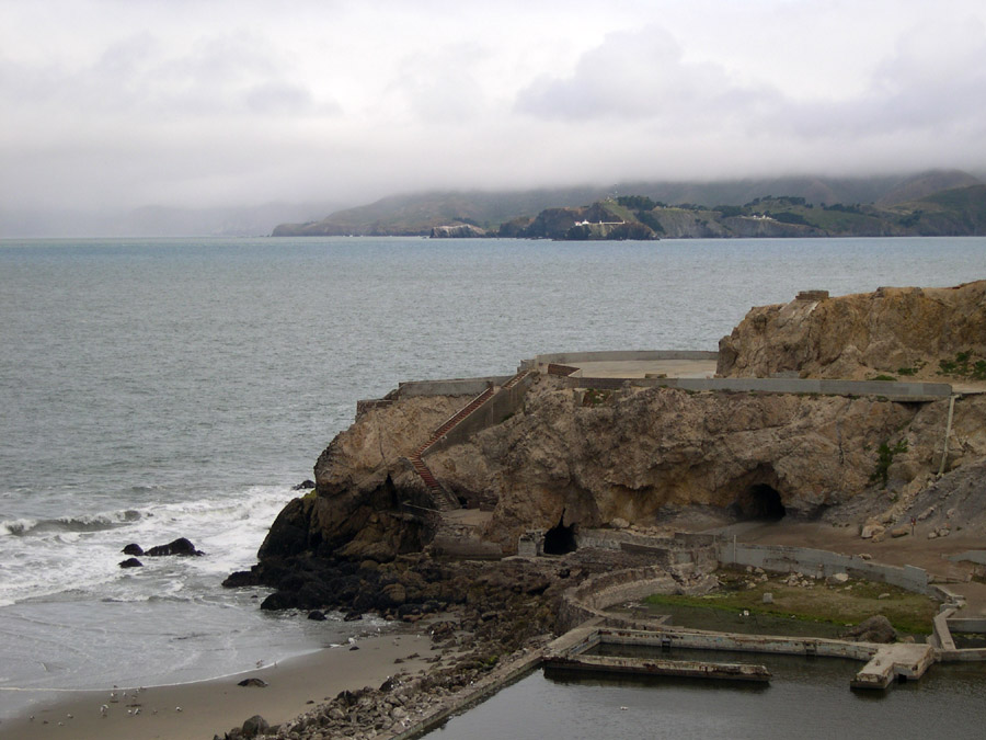
I decided to take the coast road south when leaving San Francisco. It's called
the Great Highway, and it begins here. This is a view of the Golden Gate on
the Pacific Ocean side. The famous bridge is a few miles to the right of this
picture.
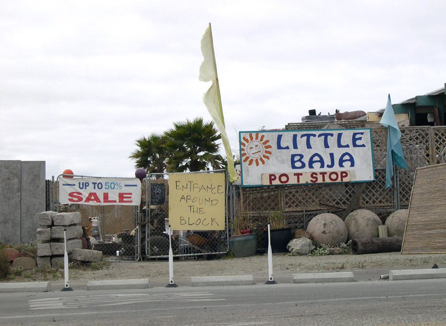
The Great Highway mentioned above joins Highway 1 somewhere south of San
Francisco. This shop is on Highway 1 in Moss Landing, at the center of Monterey
Bay. They might have called this a "Pottery Shop", but then would
I have noticed it?