SUGI Conference and Road Trip - April 2006
(SUGI stands for SAS Users Group International, an annual
professional conference I go to, which was in San Francisco this year)
SUGI/San Francisco
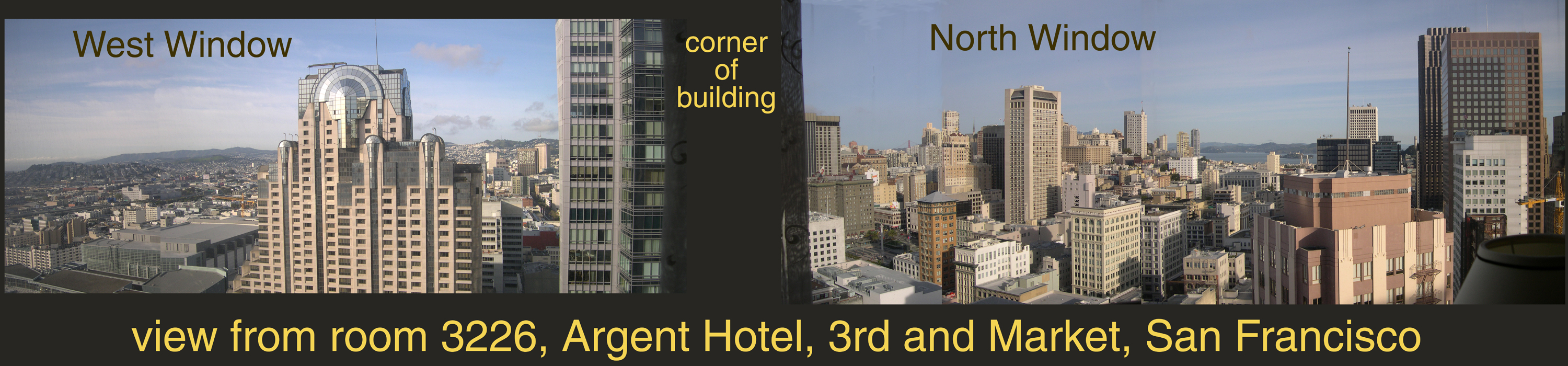
PANORAMA picture -- scroll RIGHT (or enlarge your browser window) to see entire image
This is where the conference "put me up". Way up!
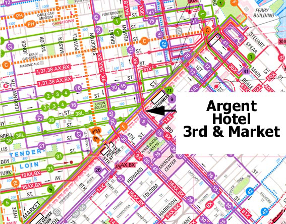
The map just below gives you an idea where we are, then
the next two pictures show more detail. These are composite
panoramas, i.e., multiple pictures later "spliced" together
using PhotoShop (of course).
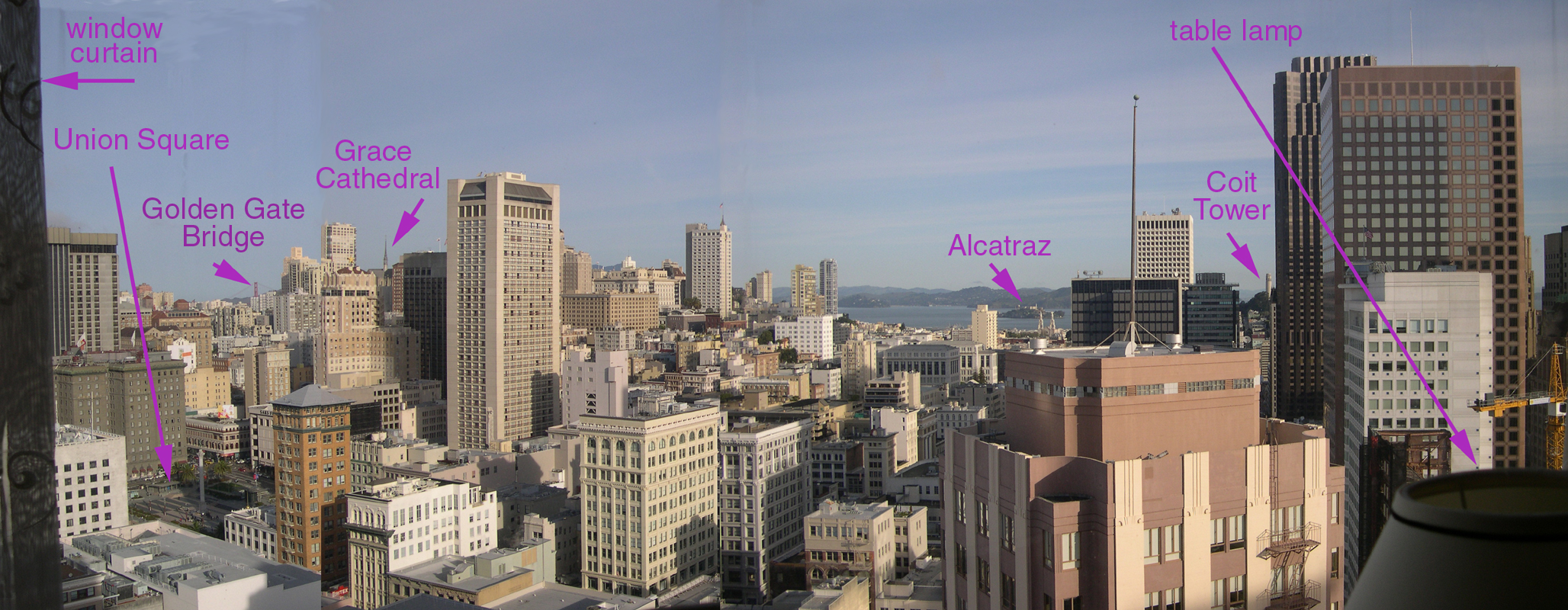
North Window (scroll right, please)
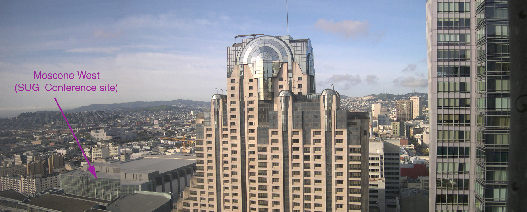
West Window (scroll right, please)
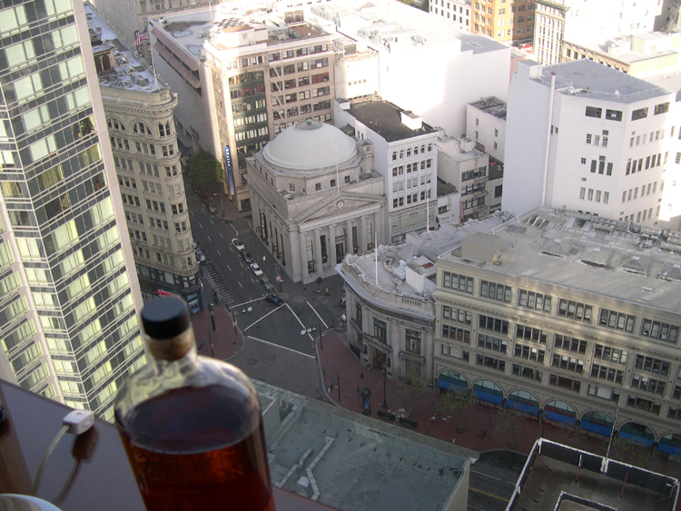
Another view, looking down from the North window of my
hotel room. The prominent
intersection where the domed building sits is O'Farrell (to the upper left)
and Grant (to the upper right) where they touch Market (generally left to
right in the picture).

Another view from the West window of my hotel room,
looking down on a church and the
Moscone (West) Center, where the SUGI Conference was held. The building
just to the West (upper right) of the park area is a shopping/theatre
complex, with Moscone West being the large building just beyond that,
in the upper-right quadrant of the picture.
I didn't find this hotel until too late to get a reservation.
Better luck next time, I guess.
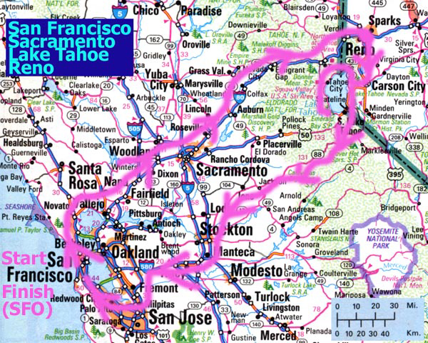
Road Trip to Reno, via Interstate 80
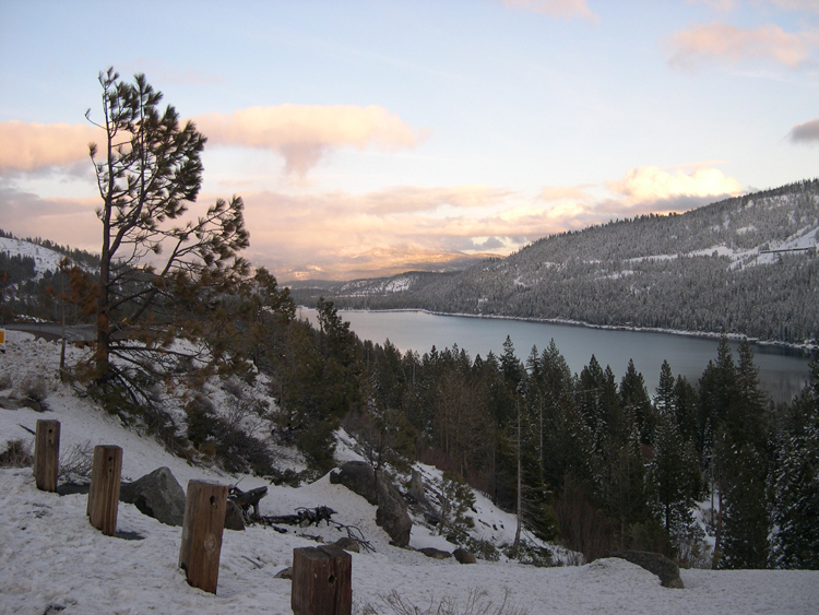
A lake in Donner Pass (don't stop to eat!).
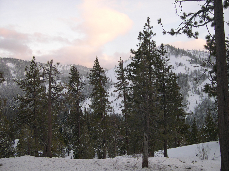
Another view along I-80.
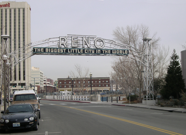
This is the famous original Reno sign, now on a street that looks
like no-one ever goes there.
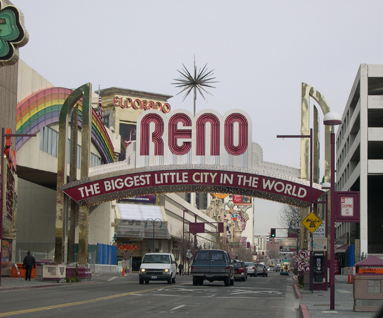
This is one of the flashy new knock-offs of the original sign, on a
street where lots of people go.
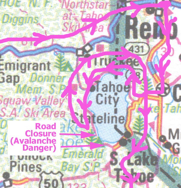
To Tahoe, then around the lake (twice)
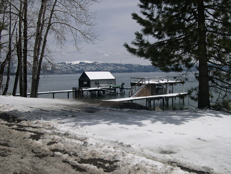
North Lake Tahoe boat landings.
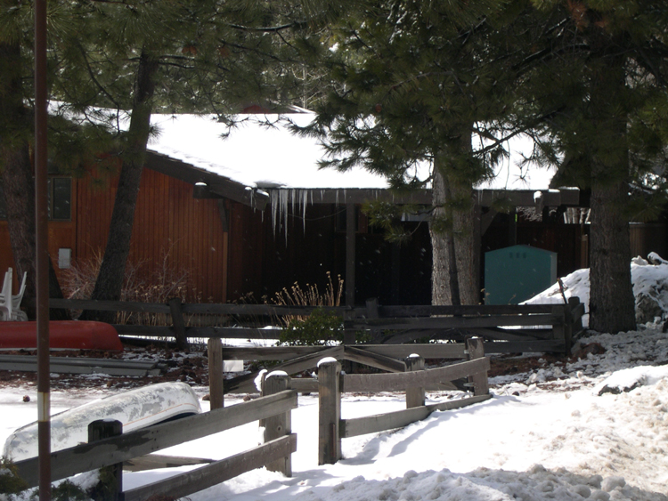
Icicles, not a common sight where I come from!

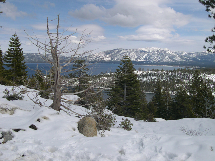
West Lake Tahoe
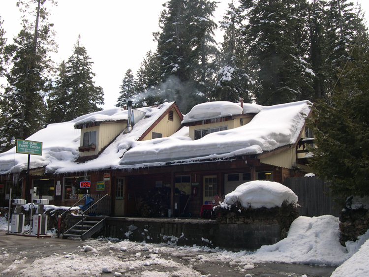
A warm, welcome sight along the West road around Tahoe
Almost Emerald Bay - 1
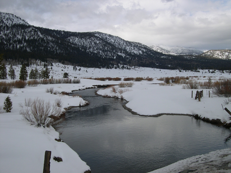
After going 3/4 of the way around Lake Tahoe, I reached a point
where the road was closed just before Emerald Bay, because of "avalanche
hazard". So, I just took pictures there, then drove all the way around
Tahoe in the other direction in order to continue the journey West, back
to the Bay Area.
Almost Emerald Bay - 2
Almost Emerald Bay - 3
High-resolution JPEG of this image available: click
here (2.4 MB)
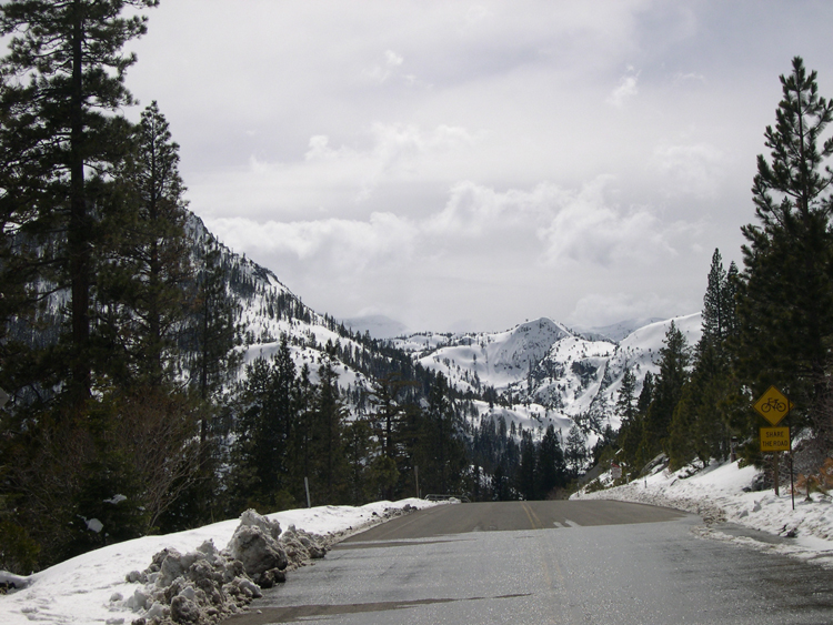
A final scene on the Westbound drive back toward the Bay Area, along
California Highway 88.
PANORAMA picture -- scroll RIGHT (or enlarge your browser window) to see entire image
This is where the conference "put me up". Way up!
The map just below gives you an idea where we are, then
the next two pictures show more detail. These are composite
panoramas, i.e., multiple pictures later "spliced" together
using PhotoShop (of course).
North Window (scroll right, please)
West Window (scroll right, please)
Another view, looking down from the North window of my
hotel room. The prominent
intersection where the domed building sits is O'Farrell (to the upper left)
and Grant (to the upper right) where they touch Market (generally left to
right in the picture).
Another view from the West window of my hotel room,
looking down on a church and the
Moscone (West) Center, where the SUGI Conference was held. The building
just to the West (upper right) of the park area is a shopping/theatre
complex, with Moscone West being the large building just beyond that,
in the upper-right quadrant of the picture.
I didn't find this hotel until too late to get a reservation.
Better luck next time, I guess.
Road Trip to Reno, via Interstate 80
A lake in Donner Pass (don't stop to eat!).
Another view along I-80.
This is the famous original Reno sign, now on a street that looks
like no-one ever goes there.
This is one of the flashy new knock-offs of the original sign, on a
street where lots of people go.
To Tahoe, then around the lake (twice)
North Lake Tahoe boat landings.
Icicles, not a common sight where I come from!
West Lake Tahoe
A warm, welcome sight along the West road around Tahoe
Almost Emerald Bay - 1
After going 3/4 of the way around Lake Tahoe, I reached a point
where the road was closed just before Emerald Bay, because of "avalanche
hazard". So, I just took pictures there, then drove all the way around
Tahoe in the other direction in order to continue the journey West, back
to the Bay Area.
Almost Emerald Bay - 2
Almost Emerald Bay - 3
High-resolution JPEG of this image available: click
here (2.4 MB)
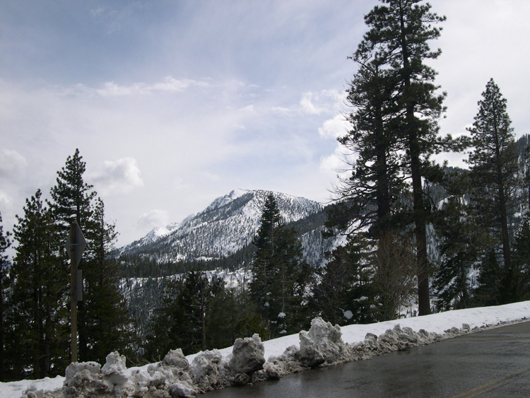
A final scene on the Westbound drive back toward the Bay Area, along
California Highway 88.