Grand Canyon, North Rim
20 May 2016
20 May 2016
photos by G.P. Jones using Nikon Coolpix L830 digital camera

This sign on State Route 120 announces that you're about to miss Benton Hot Springs, California, and its
population - a whopping 13-1/2. Wow, what parades they must have!
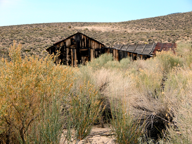
If you turn around from the sign shown above, you see this building.
It's tempting to think this may be where the 13-1/2 people in Benton Hot
Springs are all living - but it ain't so.
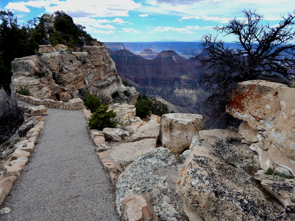
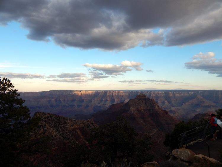
This trip was primarily so I could see the North Rim of the Grand Canyon, having missed it last year (2015) because of bad weather. (Who plans for a snowstorm on the 15th of May?) Unlike the South Rim, which has lotsa buildings and even railroad tracks, the only substantial building on the North Rim is the historic Lodge. This trail leads directly from the lodge to Bright Angel Point, an easy and quite scenic hike.

As you walk toward Bright Angel Point, the canyon opens up, seeming to go on forever.
Obviously, the Canyon speaks for itself, so most of the rest of these captions will
just describe where along the North Rim the pictures were taken.
(Contrary to popular opinion, I know when to shut up!)
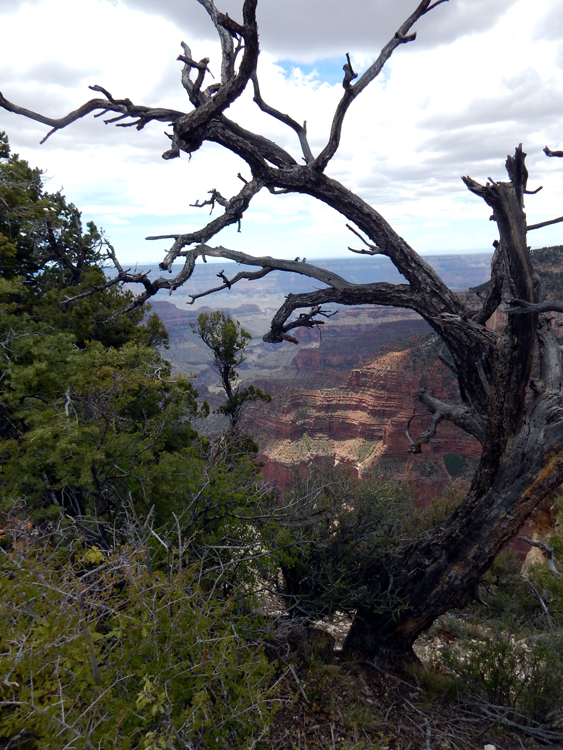
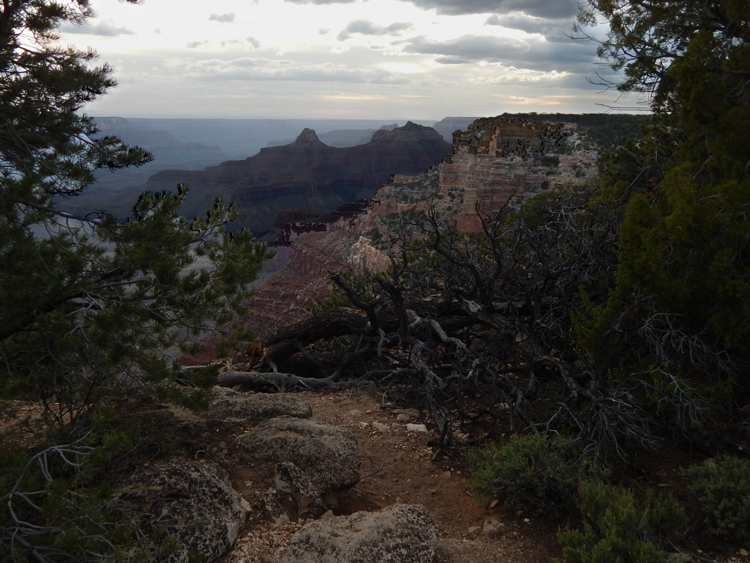
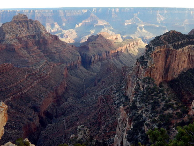
From Bright Angel Trail.
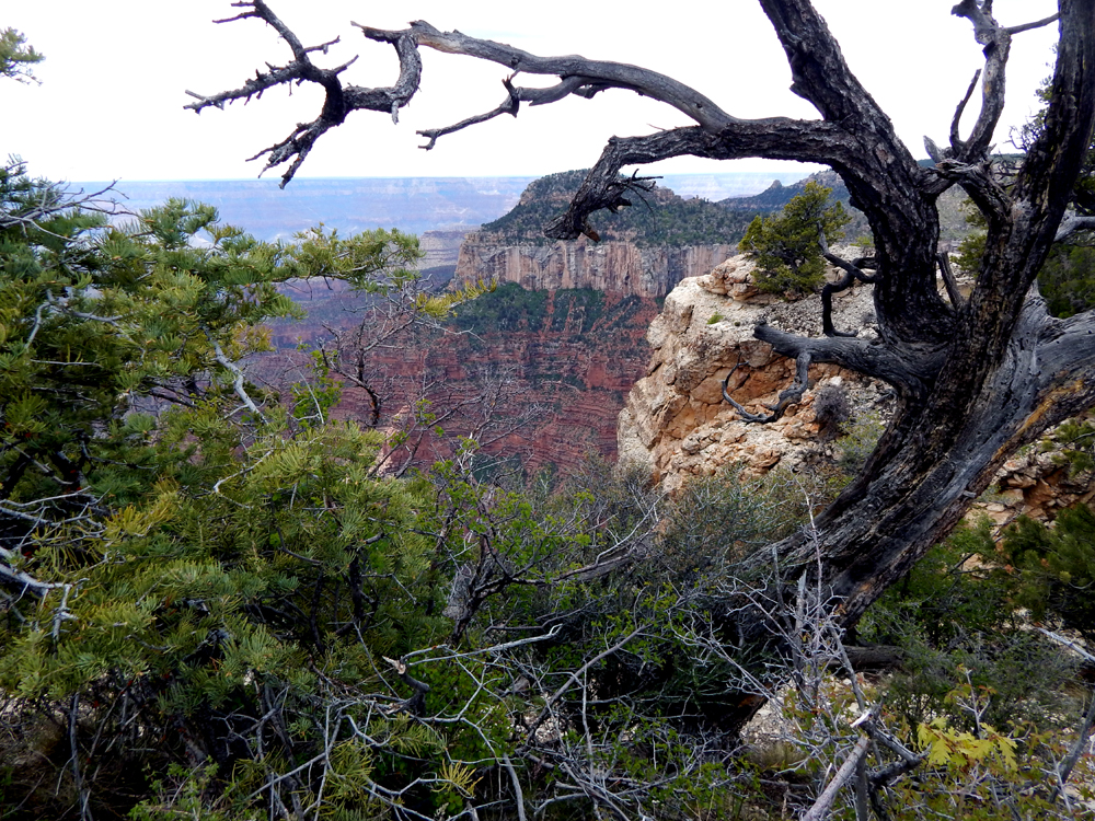
From Bright Angel Trail.
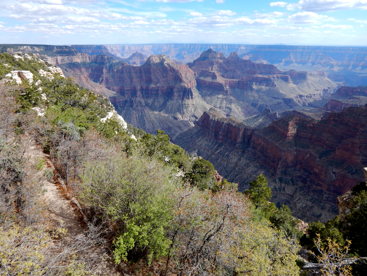
From Bright Angel Trail.

From Bright Angel Trail.

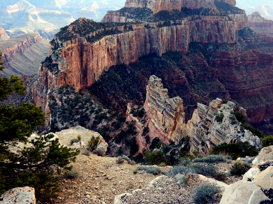
Several points on the North Rim some distance away from the Lodge and Bright Angel Point
are highly recommended. This kind of formation is particularly interesting to me.
It is basically an open hole in a wall of rock. (It is the type of formation that gives Arches National Park
its name, but seems relatively rare here in this Canyon.)
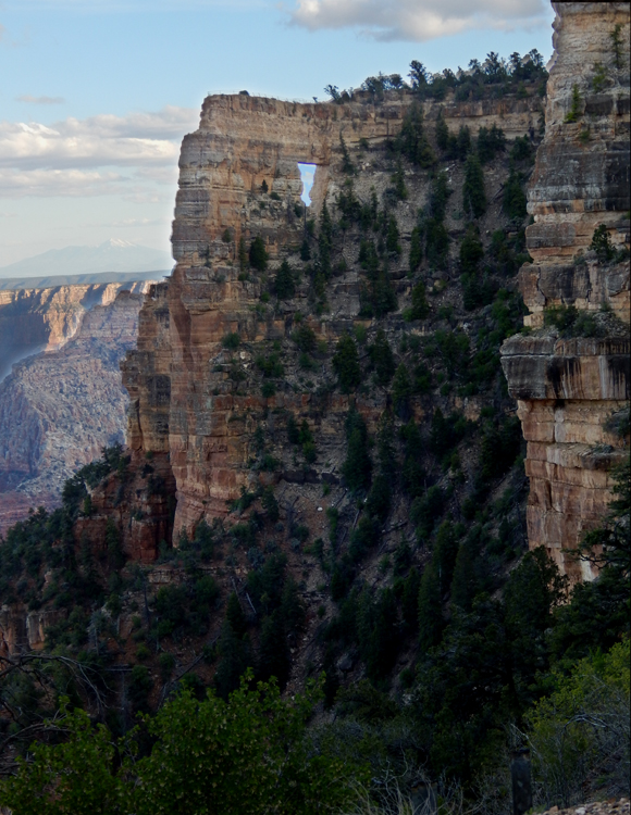
In this case, the wall of rock is Kaibab limestone.
The "hole" is known as Angel's Window.
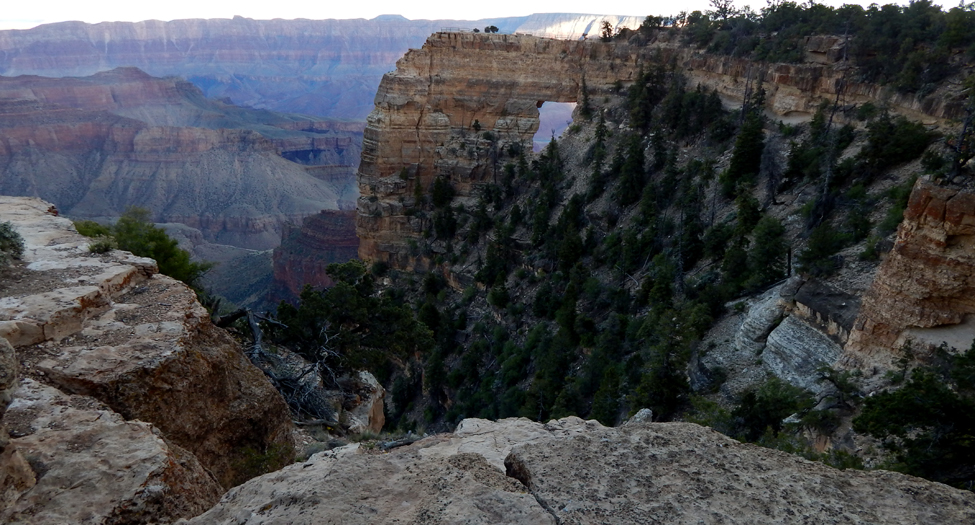
Angel's Window.
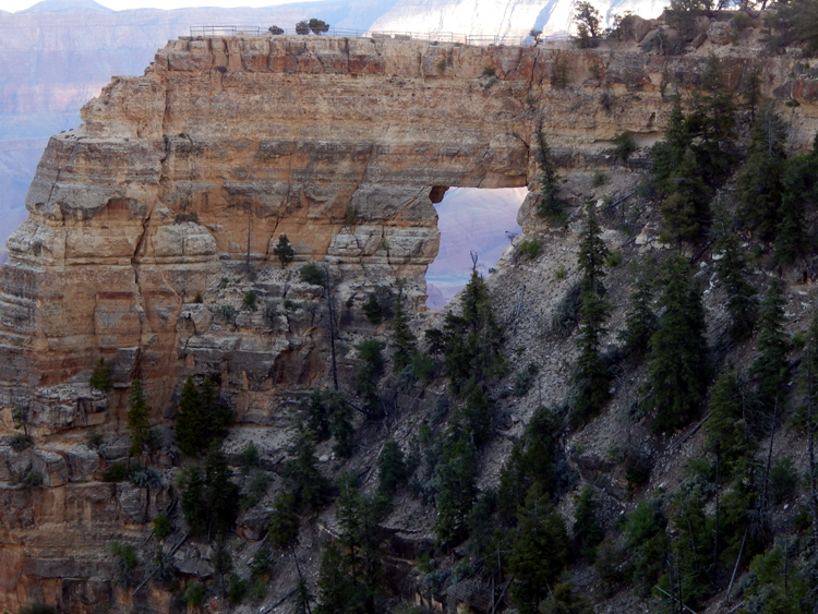
According to the sign conveniently posted at this overlook, one can see the Colorado River through
Angel's Window. Looks like it to me.
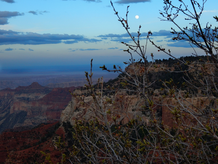
Further along the road from Angel's Window, you arrive at Cape Royal, a few hundred feet to the
left (South) of this view. Here, we're looking Westward.
Cape Royal, view to the SouthEast, as sunset approaches.
Cape Royal, I learned thanks to the helpful Park Rangers, provides views much deeper than the views available
at Bright Angel Point and the Lodge. This means (obviously) that the rock layers you see at the bottom are older.
A view from Cape Royal.
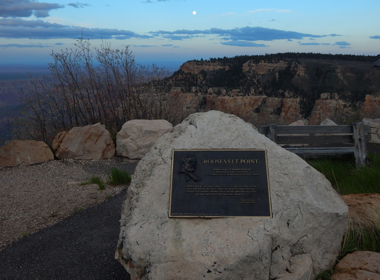
On the way back from Cape Royal to the main road, after you pass Angel's Window again,
you can visit Roosevelt Point, named for Teddy Roosevelt, whose vision ensured the preservation of
the Grand Canyon and led to the establishment of the National Park system in 1916.
As The Rough Rider said in 1903 (in words engraved on the plaque seen in the previous photo):
"Leave it as it is. You cannot improve on it. . . . The one great sight
which every American . . . should see."
I might humbly add: and be sure to see it from both the North and South rims!