Buenos Aires - Asunción - Iguazú Falls - Cairo - England - Scotland
11 August 2011 - 10 September 2011
11 August 2011 - 10 September 2011
photos by G.P. Jones using Nikon Coolpix 4300 digital
camera, except where noted
Buenos Aires - 12-13 August and 18-22 August 2011
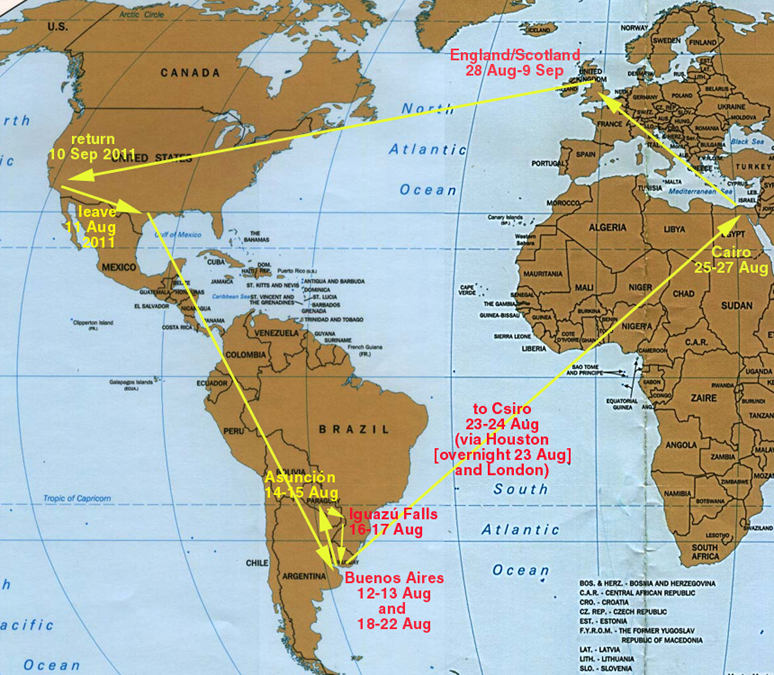
This is a panorama picture, which requires the viewer to SCROLL RIGHT to see the entire picture.
Buenos Aires is a planned city (like Paris, in many ways) with three major streets cutting across the city grid, beginning here, at the Plaza de Mayo.
The middle of the picture looks West. The major street seen at the left is the Diagonal Sur (Av. Pres. Julio A. Roca), and the one at the right is the Diagonal Norte (Av. Pres. Roque Saenz Pena). At the end of the Diagonal Norte you can see the Obelisco (shaped almost exactly like the Washington Monument in Washington, DC), located in the Plaza de la Republica. The building with the columns at the extreme right of the picture is the Catedral Metropolitana de Buenos Aires.

The Casa Rosada (right) is the Presidential residence, once the home of Evita Perón (María Eva Duarte de Perón, 1919-1952) and her somewhat lesser-known husband, the president, Juan Perón (1895-1974).
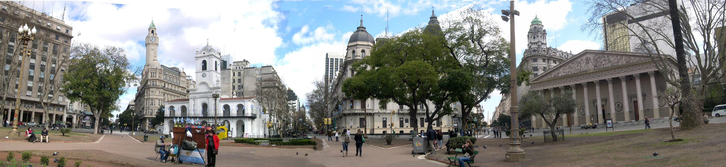
The Catedral Metropolitana (the front of which is seen in the panorama picture above) looks more like a church once you're inside. The inscription around the base of the dome seen here is EGO VICI MUNDUM - "I have conquered the world" (from John 16:33).
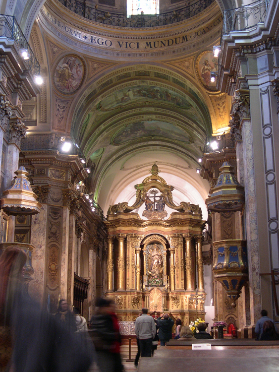
Inside the Catedral Metropolitana is a combination memorial to the "soldado desconocido de la independencia" - the unknown soldier of the [war of] independence - and El Capitan General Don Jose de San Martin, a hero of the same war. During open hours, it is attended by a live honor guard in full uniform.

The Torre Monumental dominates the park across from the Retiro railway station on the North side of the city.
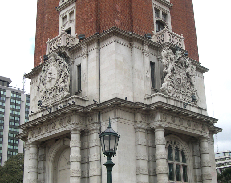
The tower is also referred to as the Torre de los Ingleses, as it was erected in 1910 by the British residents of Buenos Aires. At the left is the Argentine coat of arms, at the right the familiar British coat of arms, with the famous inscription, "Honi soit qui mal y pense" - Evil be to the one who thinks evil - the motto of the Order of the Garter. The other sides of the Torre have the same two coats of arms.
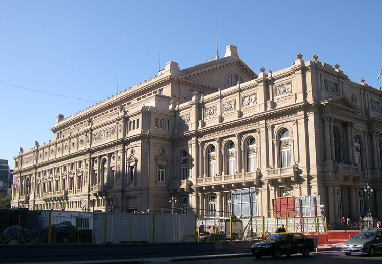
The massive (and culturally important) Teatro Colón, the opera house which opened in 1908.
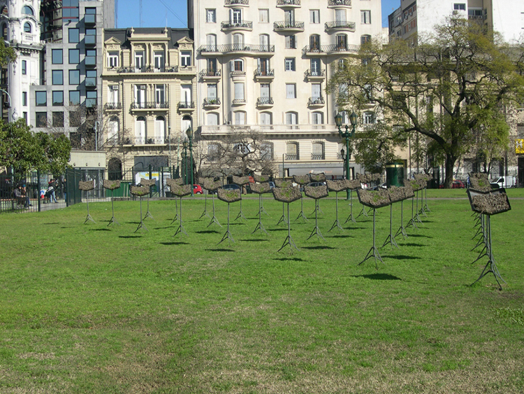
Across the street from the Teatro Colón is a park where these structures resembling music stands were constructed. Each one has what appears to be soil, with things growing in it. Art installation? Agricultural experiment? Could be both.
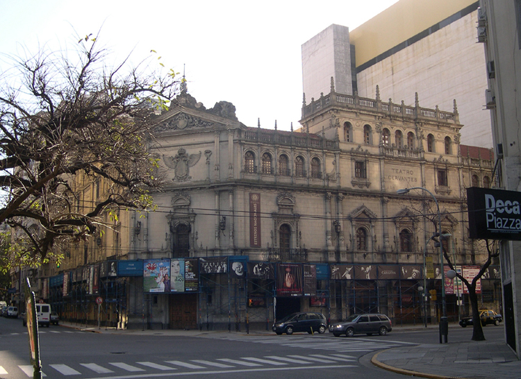
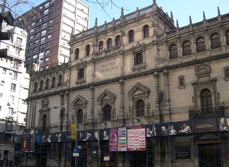
In another part of town that I hadn't seen on previous visits, another classic building houses the Teatro Cervantes (1921).

Across the street from the Teatro Cervantes stands the imposing Libertador Synagogue (built in 1892, and so named because it is located at Av Libertad 733). Note the familiar Tablets at the top of the façade reminding us all of the Ten Commandments. The building also houses the Ariel Job Jewish Community Center.
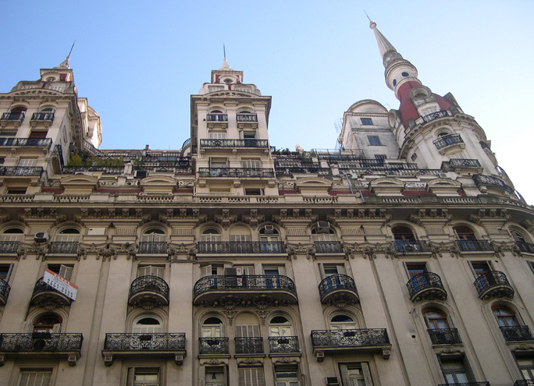
Much of Buenos Aires was built around the turn of the 20th Century, with wrought-iron balconies, towers and lots of ornamentation.
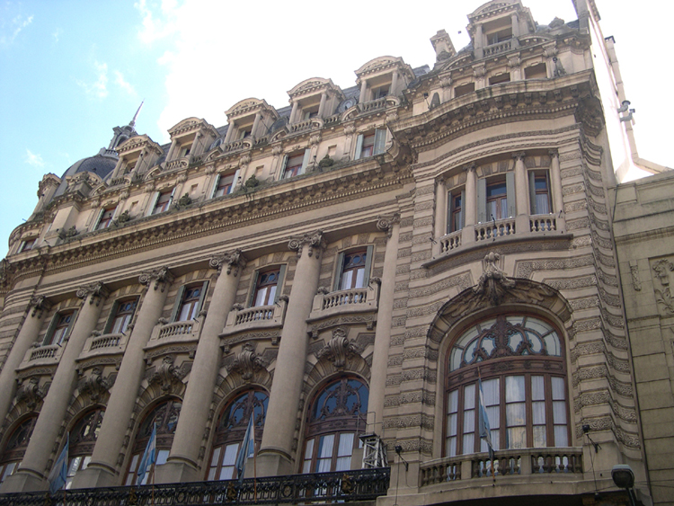
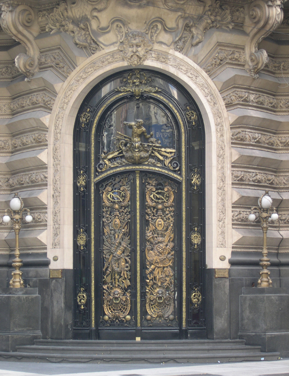
This building, and especially its gold-highlighted doorway, is most impressive. It is the Centro Naval (1914), basically a club for Naval Officers, and sits at the corner of Córdoba and Florida, the North-South shopping street closed to vehicle traffic and jammed with tourists most of the time.
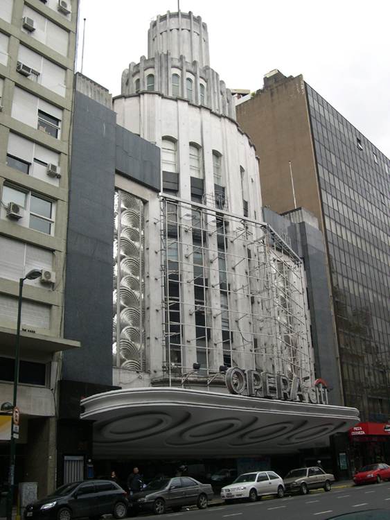
The Art Deco period (roughly 1925-1935) may have been a building slump for Buenos Aires, as there are not many examples of that style of architecture to be seen. The Teatro Opera (1936) is a notable exception.

Local (Southern California) friends who speak Spanish and most Mexicans probably will find this moving company's name as funny as I do. I'm not offering any translations, just the note that local slang has a meaning quite different from the original. Suffice to say that if they moved to Tijuana, the Verga Brothers would almost certainly have to change their names.
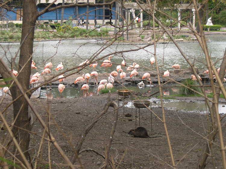
Like most major cities in the civilized world, Buenos Aires has a zoo. But how many zoos have flocks of flamingoes sharing their space with rodents the size of this one (lower center of the picture)?
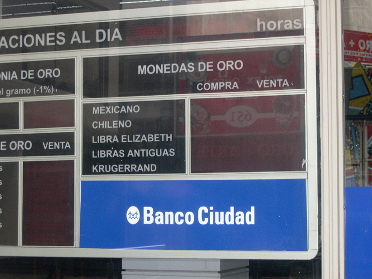
Money changers all have their quirks, I suppose. Here the British Pound is referred to as "Libra Elizabeth" (Elizabeth Pound).

As I noted in the captions of the pictures I posted from my January 2006 trip to Buenos Aires, vegetarian graffitists have an uphill battle, to say the least, in converting this carnivorous culture to their eating habits. For me, the surprised look on this poor, forked bovine's face overwhelms any message the stencil is trying to convey.
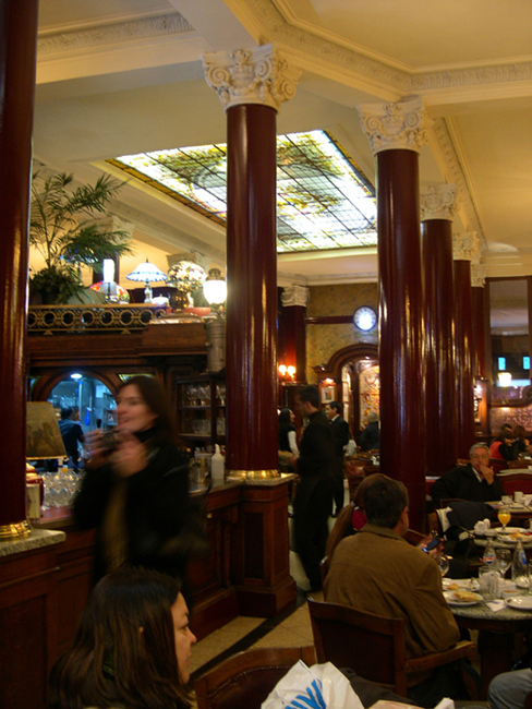
When I was planning my first visit (2006) to Buenos Aires, a colleague at work told me I should not miss the Cafe Tortoni's hot chocolate. It is, indeed, just as superb as it is expensive, and the setting - despite the Italian name - is pure fin-de-siècle Paris.
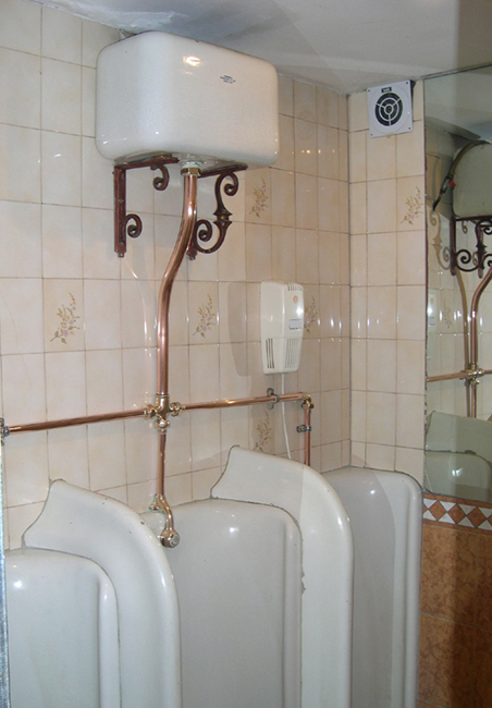
The Cafe Tortoni was opened in 1858, and I am convinced the men's room still has the original plumbing.
Asunción, Paraguay - 14-15 August 2011
NOTE: The name of the country is sometimes spelled Paragua'y
or Paraguái,
reflecting a theory of how the country was named: a combination of
the name of an ancient chief (Paragua) and the word for river (y).
Asunción is really just a short form of
"Nuestra Señora Santa María de la Asunción"
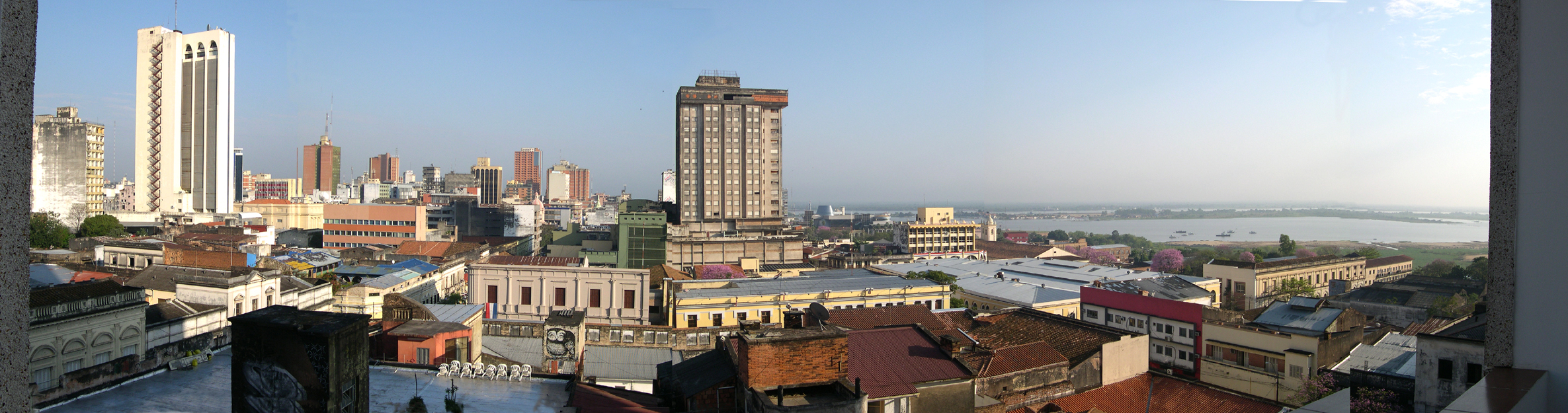
This is another panorama picture. To see the full image, SCROLL RIGHT.
This is the view of Asunción from my 7th-floor hotel room. You are looking toward the NorthWest, with the Bahía de Asunción on the right and the Rio Paraguay in the distance. Across the river (i.e., to the West) is Northern Argentina.
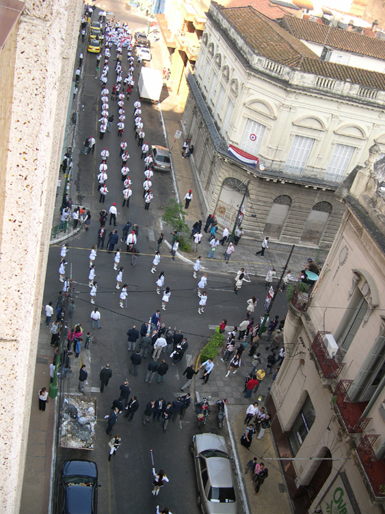
At about 8am on the first morning in the hotel, I heard a sound that was familiar to me from the many parades I had participated in during High School and College -- drumming. The street below was the beginning of a parade route for a holiday commemorating schools and education (or so the hotel staff told me).
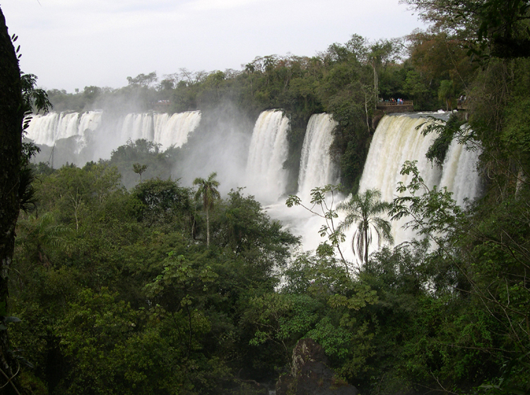
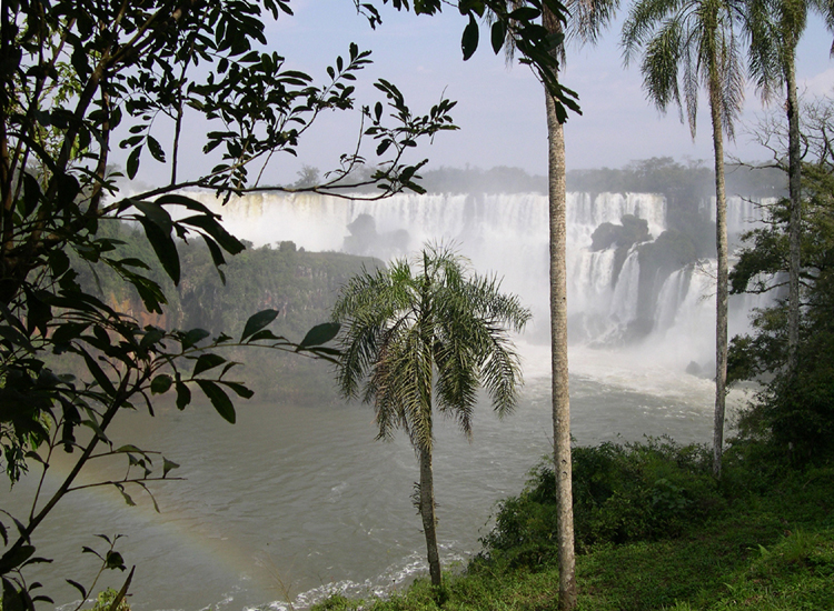
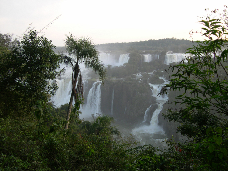
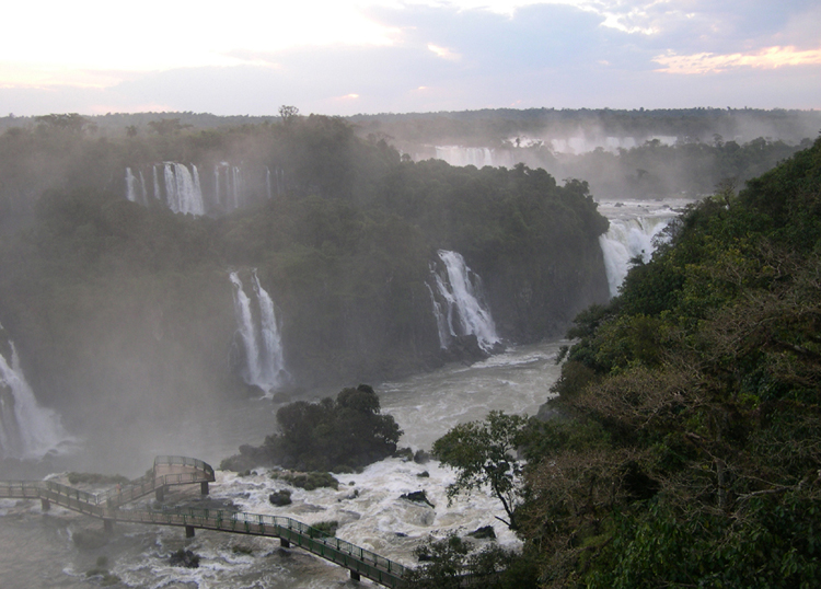
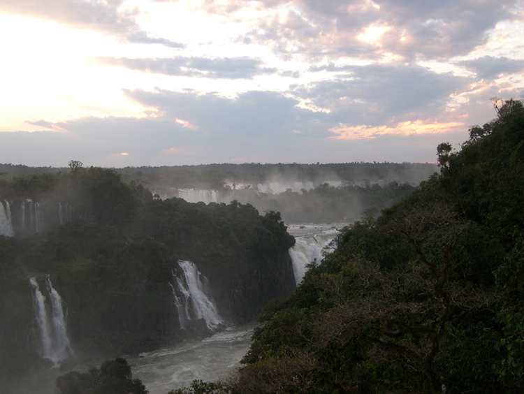
Iguazú Falls - Argentina Side - 16 August 2011
The basic reason for this trip to South America was to see for myself the world famous waterfalls which the Spanish-speakers call Iguazú, the Portuguese call Iguaçu, and illiterate hicks call Iguassu. The falls, or "Cataratas", lie on the Iguazú river, near the point where Paraguay, Argentina and Brasil all come together.
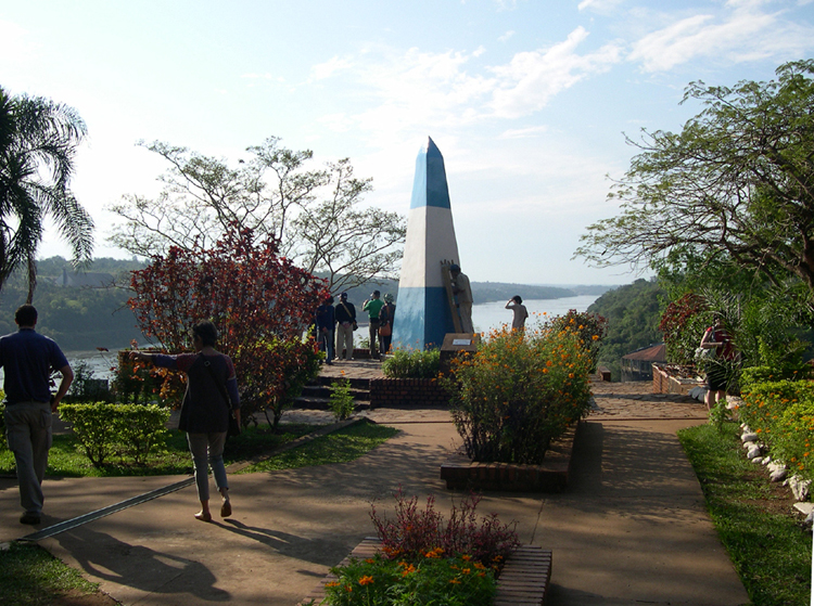
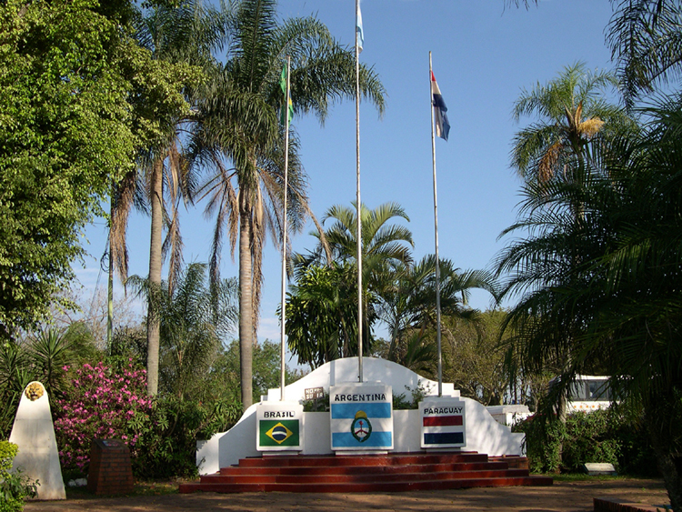
The intersection of the three countries is actually the place where the Paraná and Iguazú rivers join. Each country has set up vantage points, marked by obelisks painted with the country's colors. This is the Argentine obelisk, looking North up the Rio Paraná, with Paraguay on the left (West) and Brasil on the right (East).
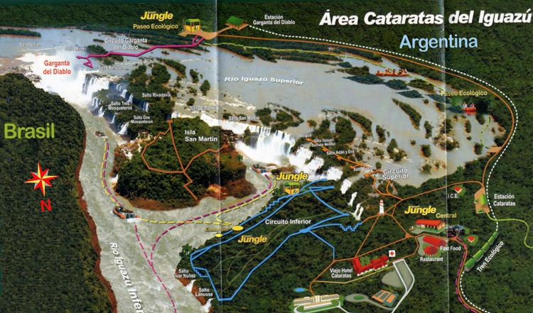
Most maps of the Iguazú Falls area are a bit disconcerting, at least to me, because they show the Devil's Throat (Garganta del Diablo in Spanish, Garganta do Diabo in Portuguese) at the top (which is usually North on most maps), when it's actually at the South end of the Falls.
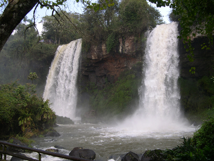
The following "tour" around the Falls begins at the long walkway (magenta on this map) to the Garganta del Diablo -- I'll use the Spanish form, since we're on the Argentina side at this point. That walkway begins at the small railway station at the top. (The railway is shown as the dotted line around the right.) From there, we'll take the railway down to the lower right for the orange Circuito Superior (upper circuit) and the blue Circuito Inferior (lower circuit). Finally, we go across the Rio Iguazú for some late-afternoon views from the Brasil side.
For what it's worth, I can't stress enough how important it is, if you take the time to visit this natural wonder, to go to both sides to take in the views. The trouble and expense of getting a Brasil visa is well worth the experience you will have. (The Argentina visa is just as expensive, but can be obtained at the airport on arrival.)

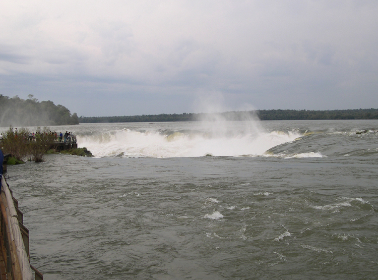
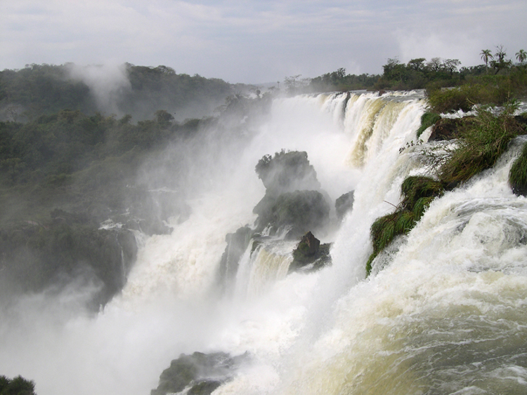
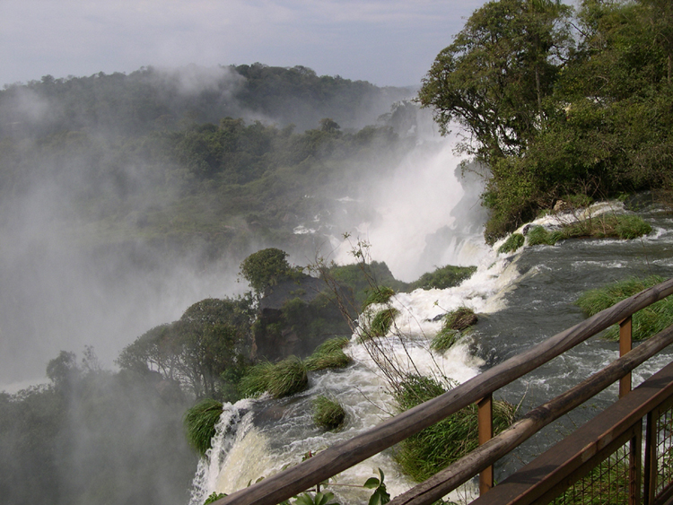
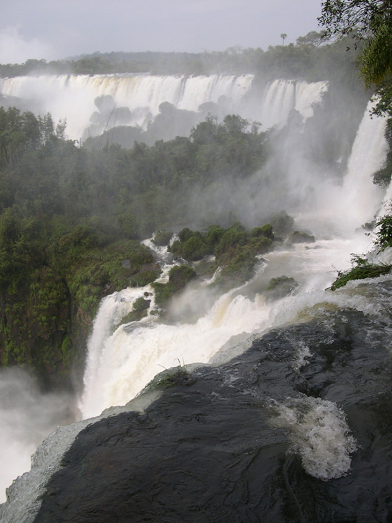
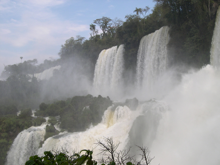
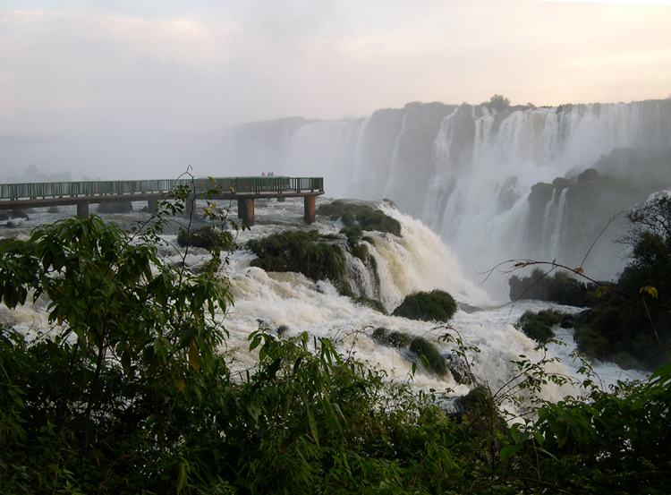
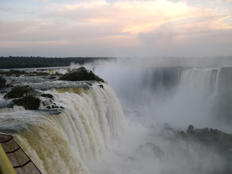
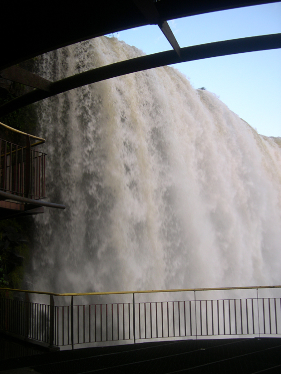
The walkways in both of the National Parks -- Argentina and Brasil -- take the visitor to the very edges of the various falls. Here the Garganta del Diablo is glimpsed on the right, with the spray from the enormous force of the cataract seen at the left.
A closer view of the Garganta del Diablo begins to give you the idea that the bottom has dropped out of the river.
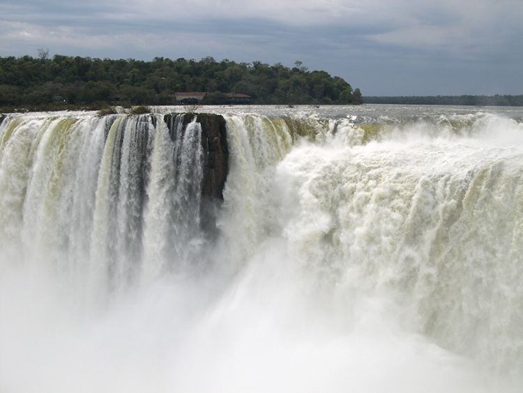
Nothing, not even the roar which surrounds you long before this point, prepares you for the experience of arriving at the end of the walkway to look down at this 82-metre drop. It is terror and thrill all at once, and you come to realize that the only appropriate name is "The Devil's Throat".
It is interesting to note that the Westernmost part of Africa's great Victoria Falls bears the name "Devil's Cataract". Click here to see my attempts to photograph Victoria Falls in 2006. To return to this page, click your browser's "Back" button.
High-resolution JPEG of this photograph available: click here (2.5 MB)
High-resolution JPEG of this photograph available: click here (2.1 MB)
For anyone who has visited both, the comparisons between Iguazú and Victoria Falls are inevitable. Both are essential visits for waterfall enthusiasts. Neither can be said to be better than the other, except perhaps for viewability (the walkways at Iguazú make it much easier to see breathtaking views and take spectacular pictures).
Here is my summary of the comparisons. The falls at Victoria are pretty much single-level, and in a straight line. At Iguazú, the falls are multi-level and arranged more like a horseshoe. Iguazú's longest drop is about 82 metres, while Victoria's is 108. The comparison chart at the Victoria Falls Wikipedia page notes further that Victoria is about 1,708 metres wide, while Iguazú is about 2,700 metres wide.
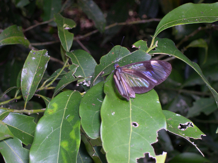
A friend who has also been to Iguazú (he's been everywhere!) told me to look for butterflies. There weren't many, as it was still technically Winter, but this one posed for a moment. This inadequate picture doesn't do justice to the almost fully-transparent wings.
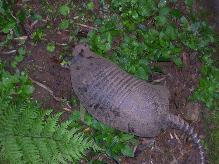
This armadillo didn't move as fast as the butterfly, so was easier to photograph.
Iguaçu Falls - Brasil Side - 16 August 2011
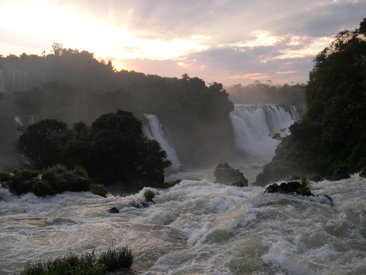
By the time I got over to the Brasil side, it was late afternoon. What luck, to look over toward Argentina and see the falls as sunset approached.

High-resolution JPEG of this photograph available: click here (2.1 MB)


This is the platform where you take the elevator back to civilization (so to speak). Here you get your final, up-close view of the falls.
At the rail, you can actually reach out and touch the edge of the waterfall. The power of this deluge cannot be described in words.
Cairo - 25-27 August 2011
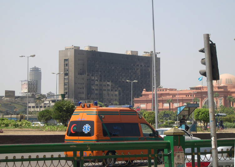
The next segment of this marathon trip is Cairo. Earlier this year (2011), the people of Egypt deposed their long-time leader Hosni Mubarak, gathering in this spot - Tahrir Square. One result of the conflict can be seen in the burned-out hotel, just to the left of the Egyptian Museum The museum itself suffered some looting but was not burned.
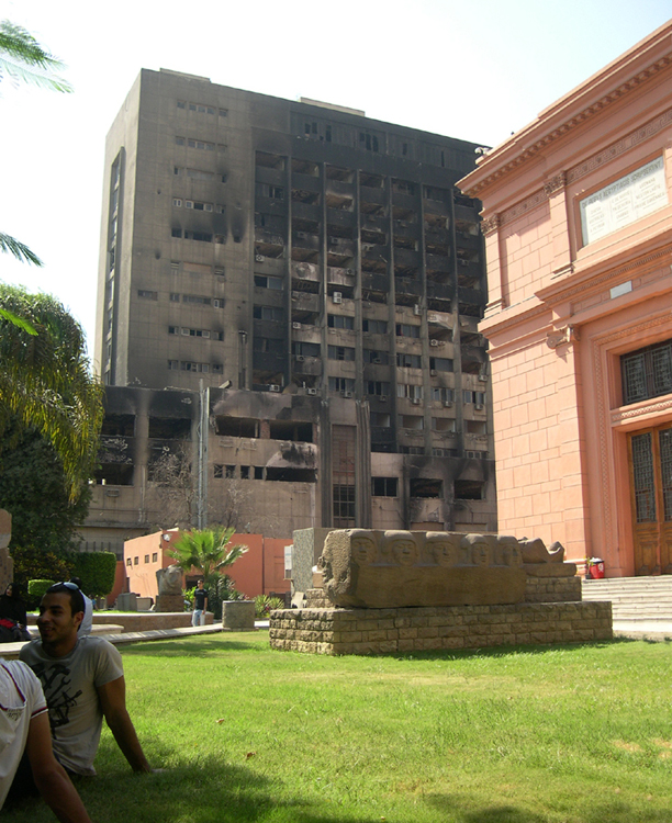
A closer view shows just how close -- about 50 feet away, I'd say -- the burned hotel is to the Museum property.
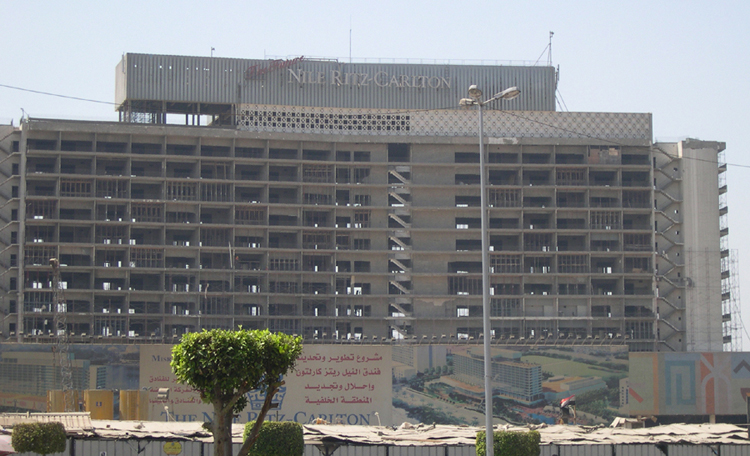
A short distance from the Museum and burned-out hotel seen in previous pictures is the shell of the Nile Ritz Carlton.
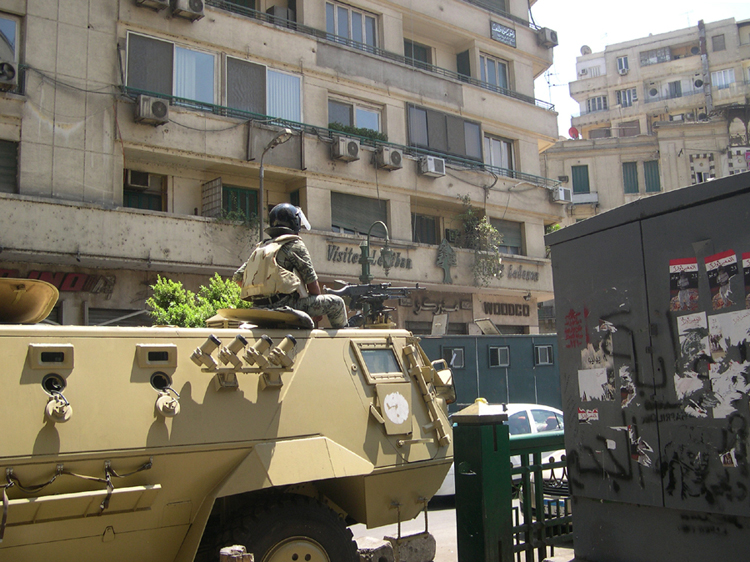
Tanks and soldiers watch over Tahrir square, perhaps an inevitable necessity.
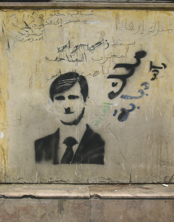
This Tahrir Square graffiti appears to show either a young Hitler or John Cleese.
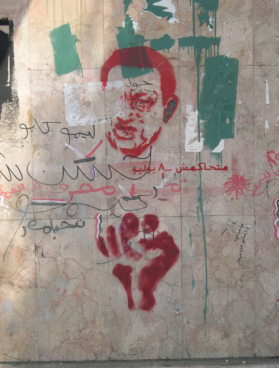
This image seems to be Mubarak. I don't read Arabic (not even close), so I can't tell whether it's meant to be supportive or otherwise. My guess is otherwise.
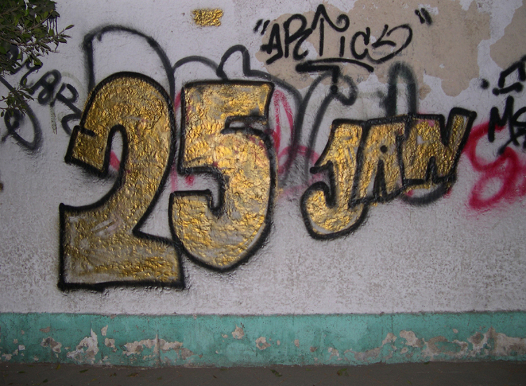
Egyptians mark 25 January 2011 as the "Day of Revolt" which ultimately forced Hosni Mubarak from power. The Twitter hashtag that reportedly played a significant role in this uprising was #jan25.
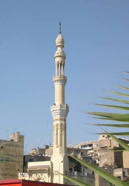
Cairo's minarets seem to me to be much more slender and tall than those in Istanbul.
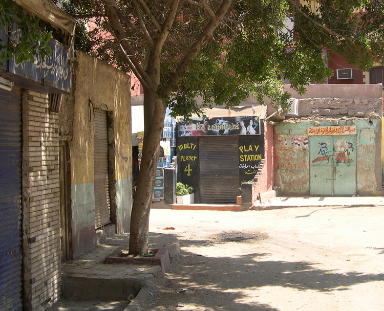
The local Play Station store in the Giza section of Cairo.
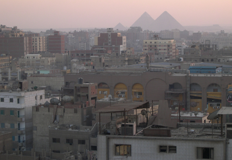
The pyramids at Giza are, to say the least, enormous monuments. This view is from the rooftop restaurant at the hotel where I stayed.

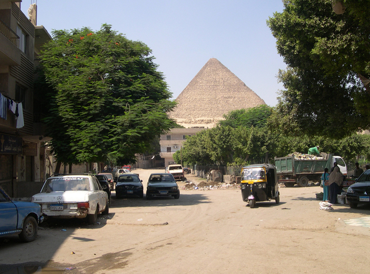
I like to "sneak up" on the world's great monuments, walking to see them, rather than taking a taxi or tour bus, whenever possible. After a couple of miles, I finally caught my first glimpse.
The Wikipedia page on the Necropolis at Giza has maps and overview photos which I couldn't provide, since my helicopter was in the shop at the time.
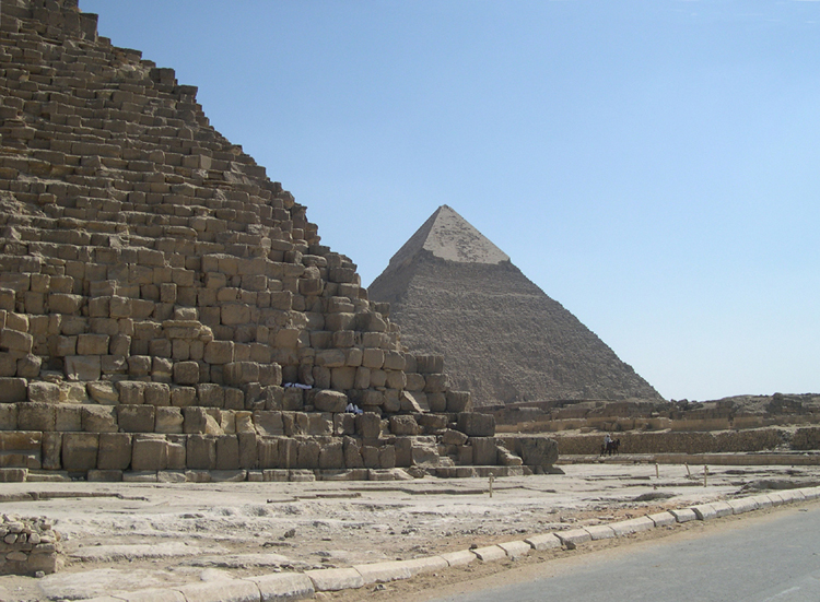
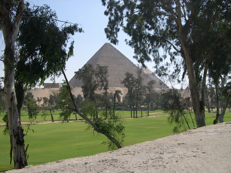
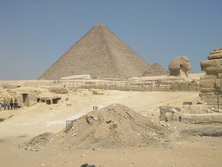
I entered the Giza Necropolis from the North gate, near the Great Pyramid of Cheops (or Khufu), the base of which you can see in this photo. The "capped" structure behind it is the somewhat smaller Pyramid of Khafre.
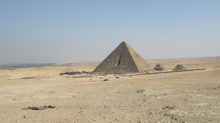
Further out into the Necropolis is the smallest of the three main structures, the Pyramid of Menkaure.
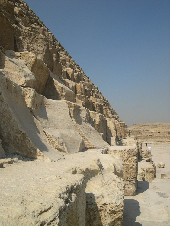
For an extra admission fee, you can go inside the Cheops and Menkaure pyramids. This picture taken near the Cheops entrance gives an idea of how large the "building blocks" are.
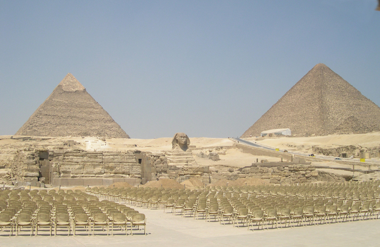
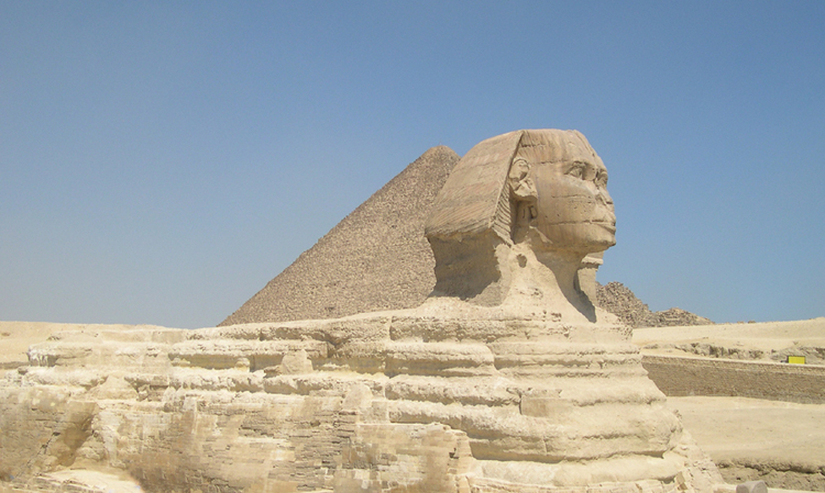
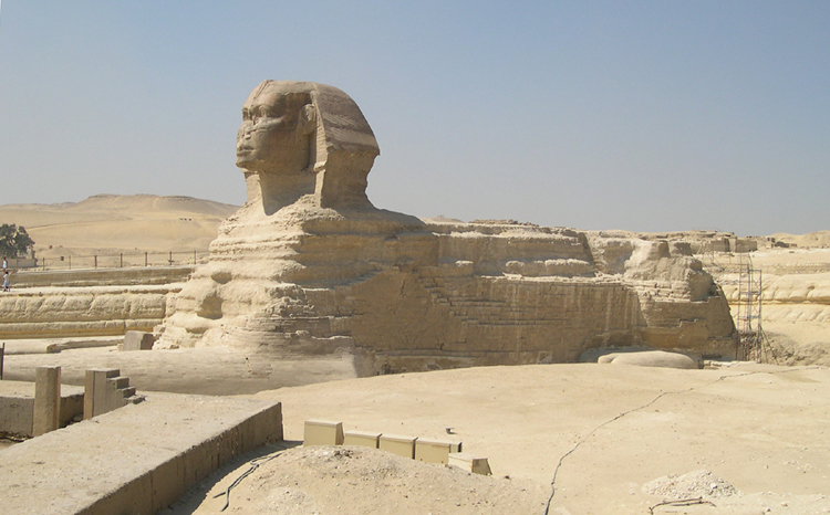
If you enter the Necropolis from the East, the first thing you will probably notice is the Great Sphinx (which Eyptians who speak English with the tourists tend to pronounce in three syllables -- sa-PHINX-uh).
One of the tourist attractions is a night-time son-et-lumière show with lasers, amplified music and other un-natural stuff. The chairs are (obviously) for the audience, not an original feature of the Giza Necropolis.
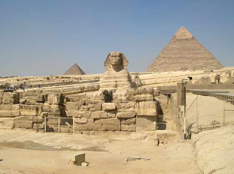
Here the inscrutable (and noseless) Sphinx is bookended by the Pyramids of Khafre (right) and Menkaure (left).
From this angle, the Sphinx appears to be buried, which it was, in fact, until the excavation of the mid-19th Century. The Great Pyramid of Cheops is in the background.
England and Scotland - 28 August - 9 September 2011
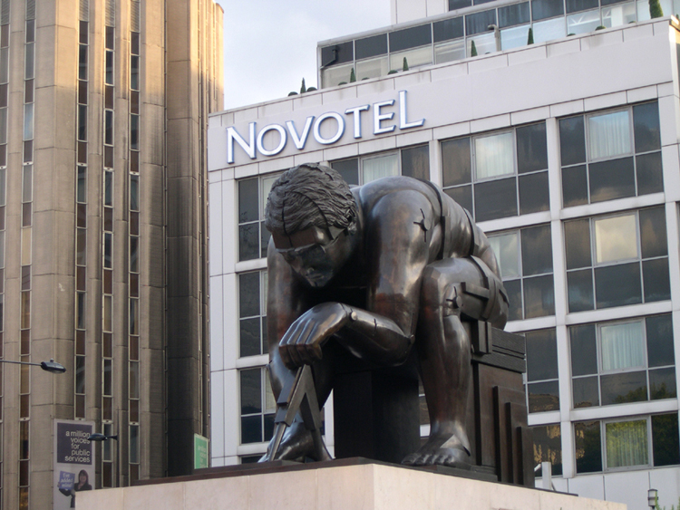
It may be appropriate that, after Cairo, my next stop was England, since many of the artifacts unearthed in Egypt now reside in the British Museum. This statue, at the relatively new location of the British Library, is of Sir Isaac Newton (as he was depicted in a 1795 print by William Blake). The sculptor was a Scottish artist with the unlikely name of Sir Eduardo Luigi Paolozzi (1924-2005). The statue was erected in 1995.
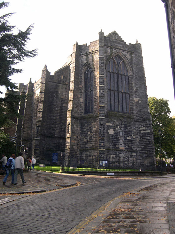
In 2008, during a short walkaround in Stirling (NorthEast of Glasgow in Scotland), I saw the town's parish church - The Church of the Holy Rude - from the outside, but wasn't able to go inside because it was October, and the church is open to weekday visitors only in the Spring and Summer months. This is the picture I took on that first visit. The term "Holy Rude" is a variant of "Holy Rood", an ancient term for the cross on which Christ was crucified.
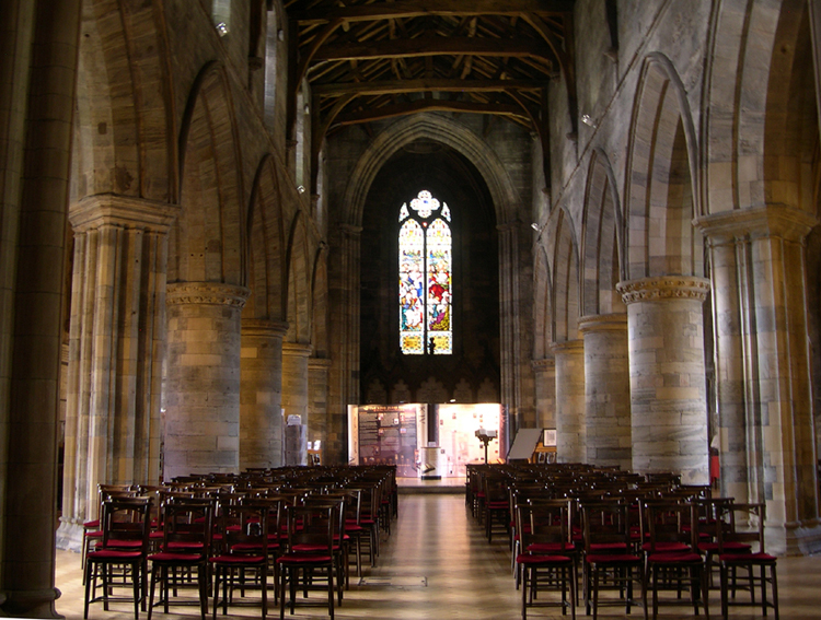
On this trip I was (finally) able to go inside and see the mediæval structure which was begun shortly after the catastrophic fire in Stirling in 1405. This is one of the few pre-Reformation Scottish churches to survive the destruction of the Calvinists. This view shows the nave looking toward the West end.
One of this church's claims to legitimate fame is that James VI of Scotland (who later became James I of England) was crowned here as a 13-month-old infant in 1567. The spot, in front of the East Window seen here, is marked by an inscription in the floor unveiled by H.M. Queen Elizabeth II in 1997.
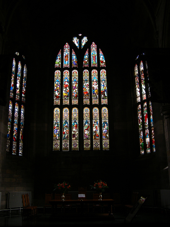
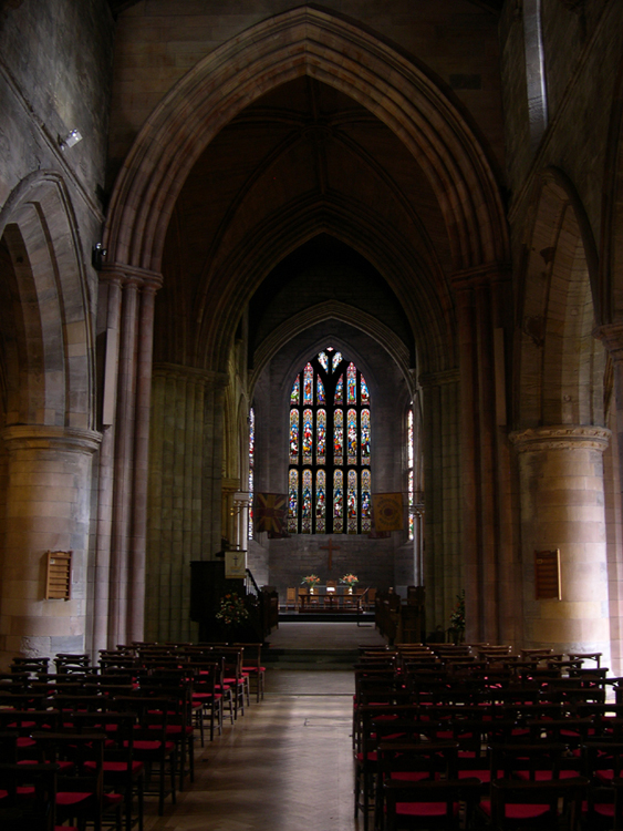
A closer view of the East Window and the angled side-windows.
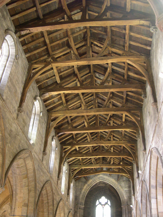
One astonishing feature of this building is that it still has the original oak roof, completed in the early 15th Century. For the mathematically challenged, that means that a wooden roof constructed about 600 years ago is still keeping the rain out.
Another surprising part of this church's long history is the fact that, in 1656, Rev James Guthrie, the conservative minister at the time developed a dislike for one of his more liberal colleagues, so he put up a wall that divided the nave (West end) from the Choir (East end), creating two separate churches. Guthrie was executed for treason in Edinburgh in 1661, but the wall remained for nearly 300 years, until 1935 when the Church was restored to its original unity.
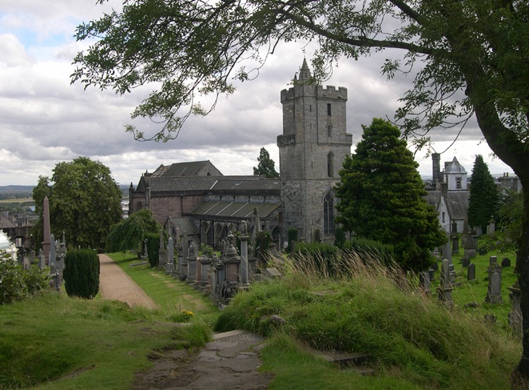
The small hill in the cemetery behind the church provides a view of the peaceful setting the church has enjoyed since the early 1400s.
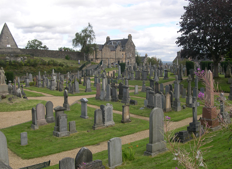
Stirling Cemetery, lying in a small valley between the Church of the Holy Rude and Stirling Castle, is picturesque in itself. The town of Stirling is down the hill to the right, while Stirling Castle sits atop the hill to the left of the pyramid.
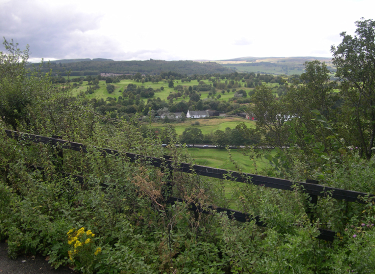
From the hill behind the Church of the Holy Rude, even the Westward view is beautiful, looking toward the Stirling Golf Club.
Next to the Church is John Cowane's hospital.
This is not an optical illusion. Apparently the North side of Stirling is a few minutes ahead of the West side.

I've seen a lot of puns used for beauty salons where nails are done, but this is the best yet.
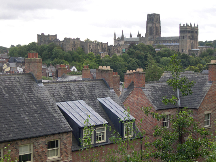
When you're on the train approaching Durham in NorthEast England, the massive Norman structure of Durham Cathedral can hardly be missed. It was begun in 1093 and largely finished in its present form just 40 years later. To the left of the Cathedral is Durham Castle, since 1840 the site of University College, Durham.

Durham Cathedral is the site of the shrine (and tomb) of St Cuthbert, who lived until 687, as well as the tomb containing the bones of the Venerable Bede (St Bede the Venerable), a monk, author and scholar who lived until 735.

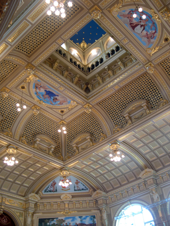
The next stop on this visit to Britain is so typical of the way I make many of my travel choices. A few years ago, I bought a DVD of some performances by the British comedy team of Hinge and Brackett. The performances were held in the Royal Hall, Harrogate, and the interior of this hall was so impressive, I decided to visit.
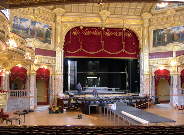
Harrogate is one of several spa towns in Britain, with mineral springs thought to be beneficial to the health. When I visited, a crew was setting up the stage area for an upcoming event.
The Royal Hall originally was a Kursaal -- Cure Hall -- designed to enhance the overall experience of the wealthy visitors seeking the water-treatment cures available at the Royal Baths and elsewhere in Harrogate.
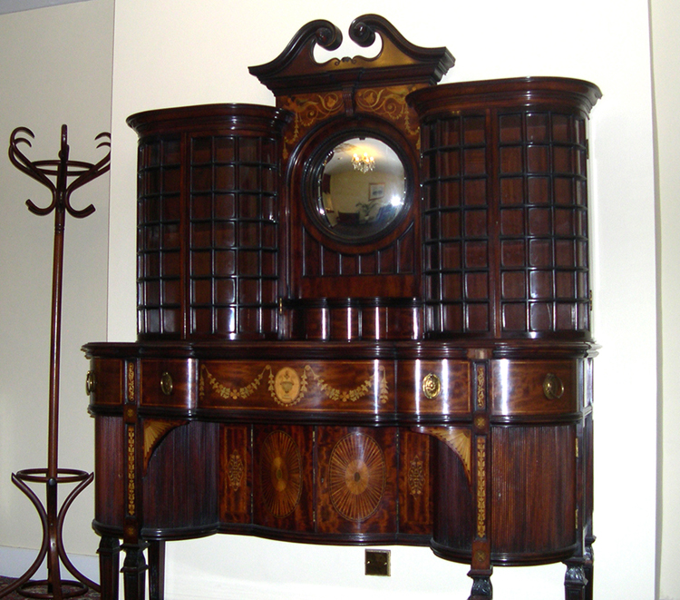
I intended to stay in Norwich after the long trip from Scotland, but the hotel had no record of my online reservation and was fully booked. Indeed, all the hotels in Norwich were fully booked, so I had to stay in a tiny seaside village 20 miles away called Mundesley. If I hadn't had to relocate, I would have missed this magnificent piece of furniture woodworking, in a hallway at the Manor Hotel.

It wasn't easy, but even though I couldn't sleep in Norwich, I still made it to the Cathedral to see the Green Man. This is what is called a "ceiling boss" - an ornamental stone carving placed at the point where the ceiling supports come together. The Green Man is a familiar image in Britain, thought to be a symbol of the pre-Christian religions centered in the woods and fields. The inclusion of such imagery in a Christian Church may be an attempt to lay claim to any power the previous religion might have held, as the Christians began to dominate the religous life of the country.
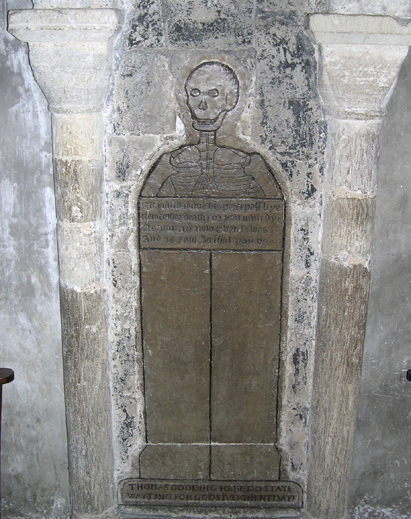
Most cathedrals have many memorials to patrons and members, but the stone carved in memory of Thomas Gooding may be one of the strangest.
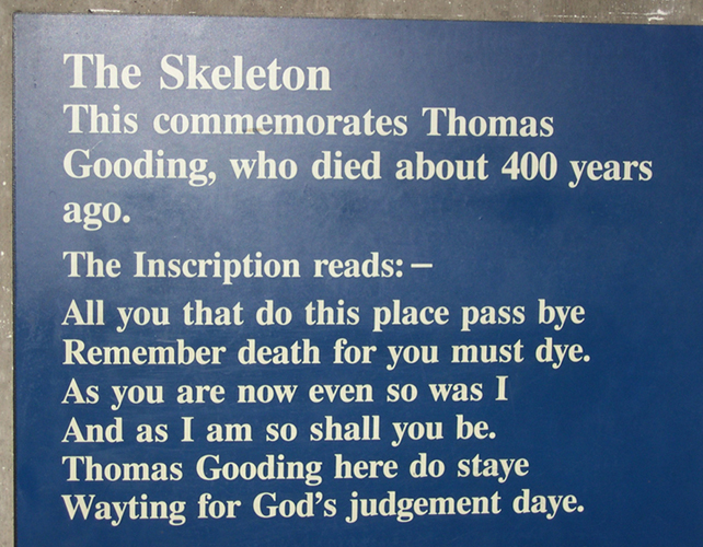
A plaque next to the "Gooding skeleton" explains what the hard-to-read inscription says.
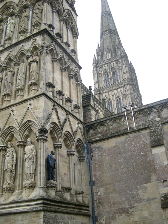
On this visit, Salisbury Cathedral (near Stonehenge) was having a temporary exhibition of the sculpture of contemporary artist Sean Henry (born 1965). The figures are lifelike, realistically-painted contemporary women and men in various poses around the Cathedral, inside and outside. At first glance the figues look like live people, which makes the barefoot businessman lying with his head on his briefcase on top of a medieval tomb, or this man standing on an otherwise empty pedestal near the West door even more striking.
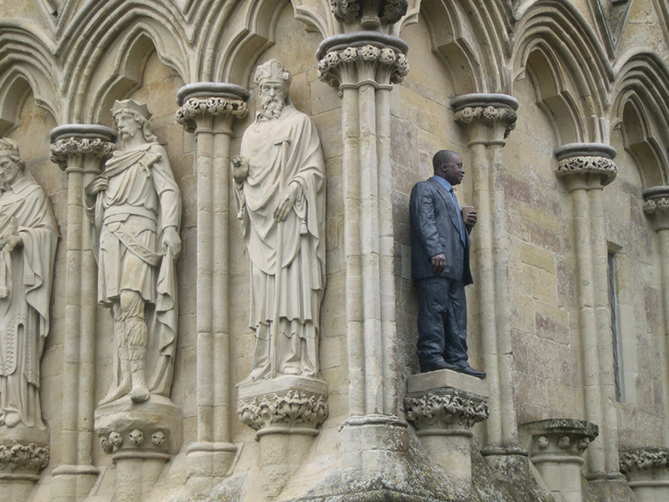
Even in close-up, the guy looks almost real. The artist was quoted as saying, "I'm interested in memorializing the everyday."